


What Are Interactive Decentralized Maps?
Forget static maps. "Interactive decentralized map forums" are a new class of digital safety tools. "Interactive" means you can click on real-time alerts. "Decentralized" is the game-changer: information is crowdsourced from a network of users on the ground,
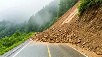
not just one central source. Drivers and locals report landslides or blockages as they happen, creating a live picture of road conditions. This user-powered approach means information travels much faster than via traditional channels, giving you a critical head-start when a route becomes unsafe.
Your Digital Toolkit for Landslide Safety
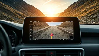
These tools are often already on your phone. **Crowdsourced Navigation Apps:** Waze and Google Maps thrive on user-generated reports for hazards and closures. Check the report time and comments for accuracy. **Official Government Apps:** These are also crucial. The 'Mausam' app provides IMD weather warnings, while the NDMA's 'Sachet' app broadcasts disaster alerts. **Hyperlocal Community Forums:** On WhatsApp, Telegram, or Facebook, these offer instantaneous, on-the-ground intelligence from residents and taxi unions in states like Himachal and Uttarakhand. Searching for these groups before your trip can be invaluable.
A Smart Traveller's Checklist
Having the tools is the first step. To use them effectively, don't rely on a single source. Cross-reference information between a crowdsourced app, an official app, and a local forum. A warning that appears across multiple platforms is likely accurate. Pay close attention to timestamps—a report from 15 minutes ago is far more valuable than one from yesterday. If you can, contribute by reporting hazards or confirming that a route is clear. Finally, remember that these apps need connectivity, which can be spotty in the mountains. Check conditions before you enter a no-network zone.
The Human Element in Tech
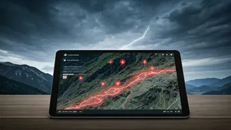
What makes these systems truly effective is the community behind them. An icon on a map is just data; a comment in a local forum saying, "Boulder fell at Chharabra, road blocked, JCB not yet arrived," provides crucial context. These forums often share alternative routes and estimate clearing times, transforming anonymous alerts into actionable knowledge. This collaborative spirit is vital during major weather events when official resources are stretched. It’s the modern version of travellers sharing news about the road ahead, powered by technology.
Balancing Tech with Official Advice
While these tools offer incredible speed, they should supplement, not replace, official guidance. Always prioritize warnings from the India Meteorological Department (IMD) and the National Disaster Management Authority (NDMA). Their directives to avoid travel are based on comprehensive risk assessments. Use interactive maps for tactical, route-specific decisions—like choosing between two local roads—but rely on official alerts for the big question of whether you should be travelling at all. In a crisis, their instructions are paramount.