






ISRO’s Eyes on the Ocean
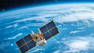
The Indian Space Research Organisation (ISRO) operates a series of Earth Observation satellites specifically designed to study the oceans. The latest and most advanced of these is OceanSat-3, also known as EOS-06, which was launched in November 2022.
This satellite is part of a legacy that started with OceanSat-1 in 1999, aimed at providing crucial data for oceanography, climate studies, and marine resource management. Orbiting in a sun-synchronous path, EOS-06 circles the globe, providing comprehensive and continuous data about the biological and physical state of the world's oceans. It’s equipped with a suite of advanced instruments, but the star player for finding fish is the Ocean Colour Monitor (OCM-3).
The Science of Seeing Colour
So, how does a satellite find fish by looking at colour? The short answer is: it doesn't look for fish, it looks for their dinner. The Ocean Colour Monitor is a sophisticated instrument that can detect subtle variations in the colour of seawater across 13 different spectral bands. These colour changes are primarily caused by the presence of phytoplankton, microscopic marine plants that form the base of the oceanic food web. Phytoplankton contain chlorophyll, which absorbs certain wavelengths of light and reflects others, changing the colour of the water from deep blue to shades of green. The OCM-3 can measure this chlorophyll concentration with remarkable accuracy. Essentially, where there’s a lot of chlorophyll, there's a lot of phytoplankton.
From Chlorophyll to a Better Catch
The link is simple: where there are dense blooms of phytoplankton, you'll find small fish that feed on them. And where there are small fish, you will find the larger, commercially valuable fish that prey on them. ISRO's satellite data on chlorophyll concentration, along with sea surface temperature and wind data, is relayed to the Indian National Centre for Ocean Information Services (INCOIS). Scientists at INCOIS analyse this data to identify 'Potential Fishing Zones' (PFZ) – areas with a high probability of fish aggregation. These advisories, pinpointing locations with coordinates, depth, and distance from shore, are then sent out daily to over 2.75 lakh fishermen via SMS, mobile apps, and digital display boards at landing centres, often in local languages.
A Game-Changer for Fishermen
For India's nearly four million coastal fishermen, this service has been revolutionary. Instead of spending hours and significant amounts of fuel searching randomly for shoals, they can head directly to the most promising locations. This has led to a significant increase in their catch-per-unit-effort. Studies have shown that fishermen using PFZ advisories can dramatically improve their earnings. Furthermore, the savings on diesel are enormous. One study in Maharashtra found that a single fishing village saved 70,000 litres of diesel in just one month by following the satellite-guided advisories. This not only improves profitability but also reduces the carbon footprint of the fishing industry.
Predicting the Weather and Ensuring Safety
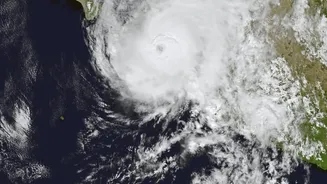
The benefits of OceanSat extend beyond fishing. The data collected by its instruments, especially the scatterometer which measures ocean surface wind speed and direction, are critical inputs for weather forecasting models. This information is particularly vital for predicting the formation, intensification, and track of cyclones in the North Indian Ocean. Assimilating satellite-derived wind data into weather models has been shown to improve cyclone track forecasts by up to 47% and landfall predictions by 37%. This provides more accurate and timely warnings, allowing for better disaster preparedness and saving lives in vulnerable coastal regions. The satellites also contribute to safety at sea through Distress Alert Terminals, which use the satellite network to relay emergency signals from boats in trouble to the Coast Guard.