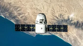









A New Orbit, A New Perspective
Most Earth-observation satellites circle the globe in a Low Earth Orbit (LEO), capturing images of specific locations only when they pass overhead. In contrast, EOS-05 is a geosynchronous satellite. It operates at an altitude of about 36,000 kilometres,
where its orbital speed matches the Earth's rotation. This allows it to remain seemingly fixed over the Indian subcontinent, providing continuous, near real-time imagery of a vast geographical area instead of intermittent glimpses. This constant watch is the technological game-changer that sets this mission apart.
From Setback to Success
The journey to this capability was not without challenges. An earlier attempt to place a similar satellite, EOS-03 (also known as GISAT-1), into orbit failed in August 2021 due to a technical anomaly in the GSLV-F10 rocket's cryogenic upper stage. The loss was a significant setback. However, the successful launch of EOS-05 aboard the GSLV-F17 not only redeems that mission but also reinforces confidence in the GSLV launch vehicle. This launch was ISRO's first success of 2026 and represents a crucial comeback, putting India's geosynchronous imaging ambitions firmly back on track.
Transforming Disaster Management
One of the most significant impacts of geosynchronous imaging will be in disaster management. Current satellites might capture a 'before' and 'after' image of a flood or cyclone, but EOS-05 can track these events as they unfold. This allows for real-time monitoring of a cyclone's path, the spread of forest fires, or the advance of floodwaters. For disaster response agencies, this constant stream of data is invaluable, enabling quicker, more informed decisions about evacuations, resource deployment, and damage assessment, ultimately saving lives and property.
A Boost for Agriculture and Infrastructure
Beyond emergencies, continuous observation offers profound benefits for national planning. In agriculture, the satellite can monitor crop health, assess water stress in farmlands, and provide data for better resource management. For urban planners, this technology helps track urban sprawl, monitor infrastructure projects, and manage natural resources more effectively. By providing a persistent, large-scale view, EOS-05 can supply crucial data to drive economic development and ensure sustainable growth.
Enhancing National Security
The strategic implications of a persistent 'eye in the sky' are also immense. A geosynchronous imager provides an unprecedented ability to monitor borders and areas of interest with 24/7 vigilance. Unlike LEO satellites with predictable pass-over times, a GEO satellite offers constant surveillance, a significant advantage for national security and defence. This capability enhances India's strategic autonomy, providing critical intelligence for monitoring regional developments and securing national assets.