


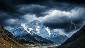


First, What Is a Western Disturbance?
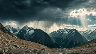
Think of a Western Disturbance (WD) as a massive, moisture-laden storm that originates far away in the Mediterranean region. These are not tropical cyclones like the ones that form over the Bay of Bengal; they are 'extratropical' storms that form in the mid-latitudes.
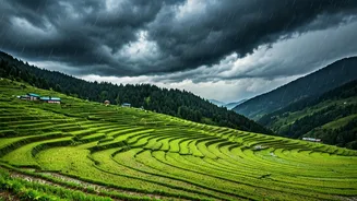
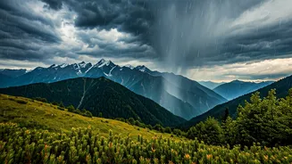
Propelled by high-altitude jet stream winds, they travel eastward across Iran, Afghanistan, and Pakistan before arriving over the Indian subcontinent. As they move, they gather moisture from the Caspian Sea and the Arabian Sea. When these systems collide with the formidable Himalayas, they are forced to rise, causing the moisture to condense and fall as heavy rain in the northern plains and, crucially, as snow in the high-altitude mountains. They are the primary engine of India's winter precipitation, essential for replenishing water sources for the entire year.
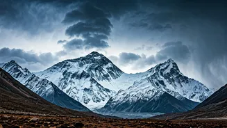
The Significance of 'Early' Snowfall
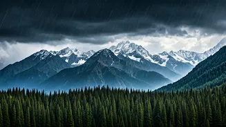
Typically, the peak season for intense Western Disturbances is from December to February. While weaker systems can occur earlier, a strong, 'fresh' disturbance bringing widespread, heavy precipitation in October or November is considered early. This timing is critical. An early snowfall can disrupt the end of the tourist season, cause premature road closures in states like Himachal Pradesh, Uttarakhand, and Jammu & Kashmir, and trap residents in remote, high-altitude villages. Agriculturally, while the moisture is welcome for the sowing of rabi (winter) crops like wheat, an early, intense downpour can also damage the ready-to-harvest kharif crops like paddy. Meteorologists and climatologists pay close attention to these early systems as they can be harbingers of the winter's overall character—will it be wetter, colder, or more erratic than usual?
The Science Behind the Early Arrival
So why is this happening now? The behaviour of Western Disturbances is governed by the subtropical westerly jet stream—a ribbon of very strong winds in the upper atmosphere. During winter, this jet stream shifts southwards, steering these storms towards northern India. An early and more pronounced dip in the jet stream can pull these disturbances in ahead of schedule. Several larger climatic factors can influence this. For instance, interactions with other global weather patterns, such as the El Niño-Southern Oscillation (ENSO), can alter atmospheric pressure and wind flows. Furthermore, scientists are increasingly studying the link between warming in the Arctic and more frequent, meandering patterns in the jet stream. While it's difficult to attribute a single weather event directly to climate change, the observed trend is that Western Disturbances are becoming more frequent and intense, and their patterns are less predictable than in the past.
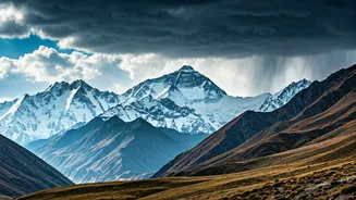
A Mix of Blessing and Trouble
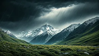
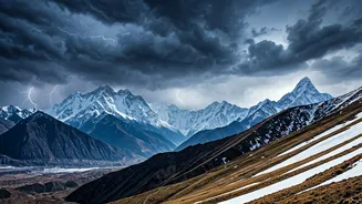
The impacts of an early, strong WD are a classic double-edged sword. On the one hand, the snow is a vital deposit into our 'water bank'. It replenishes the Himalayan glaciers, which are the source of perennial rivers like the Ganga, Indus, and Brahmaputra that support millions of people downstream. A healthy snowpack ensures adequate water for drinking, irrigation, and hydropower generation through the hot summer months. However, the immediate consequences can be disruptive and dangerous. Heavy, early snow can lead to avalanches, damage infrastructure like power lines and communication towers, and pose a severe risk to apple orchards in Himachal and Kashmir, where harvesting might still be underway. It halts trekking and mountaineering activities, impacting local economies that depend on autumn tourism.
What This Signals for Our Winters
This early drenching of the Himalayas isn't just an isolated weather event; it's a data point in a larger, evolving story about our climate. Climate models suggest that in a warming world, the intensity of precipitation from Western Disturbances may increase. This means we could see more extreme events—longer dry spells punctuated by very heavy, concentrated snowfall and rain. For a region as ecologically fragile and densely populated as the Himalayan belt and the Indo-Gangetic plains, this poses enormous challenges. It requires a shift in how we manage our water resources, prepare for disasters, and plan our agricultural cycles. This fresh disturbance serves as a powerful reminder that understanding these complex atmospheric systems is no longer just an academic exercise; it's essential for our water and food security.