



A Second Chance for a Critical Asset
The story of GISAT-1A is one of perseverance. Its predecessor, GISAT-1 (also known as EOS-03), was lost during a launch failure in August 2021. The GSLV rocket carrying it malfunctioned minutes after lift-off due to a technical anomaly in its cryogenic
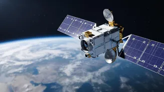
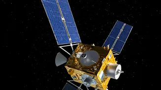
upper stage, preventing the satellite from reaching orbit. Now, five years later, the Indian Space Research Organisation (ISRO) is making a second attempt with a replacement satellite, designated GISAT-1A or EOS-05. Scheduled for an early September launch, this mission represents more than just a satellite deployment; it's a critical effort to finally secure a long-planned capability for the nation.
The Geostationary Advantage: Always Watching
What makes this satellite so different? Most Earth observation satellites are in Low-Earth Orbit, circling the globe and passing over a specific area for only a few minutes at a time. GISAT-1A, however, is a Geo-Imaging Satellite designed for a geostationary orbit, approximately 36,000 kilometres high. At this altitude, its orbital speed matches the Earth's rotation, allowing it to remain seemingly fixed over the Indian subcontinent. This provides a persistent, near-constant watch over a vast area, a true game-changer for monitoring rapidly evolving events. Instead of waiting for the next pass, authorities could get updates for a selected area every five minutes and an image of the entire country every half hour.
Transforming Disaster Management
For a country that frequently faces floods, cyclones, and forest fires, this near real-time capability is invaluable. During a cyclone, a geostationary satellite can track its formation and movement continuously, providing more accurate forecasts and lead time for evacuations. When floods strike, authorities can monitor the spread of water in real-time, identifying the worst-hit villages and planning rescue operations more effectively. This constant stream of data helps emergency managers deploy resources strategically, assess damage quickly, and ultimately, save lives. The technology allows for a shift from reactive response to proactive management.
Beyond Natural Disasters
While its primary role is in disaster response, the applications of GISAT-1A extend much further. The same persistent monitoring is crucial for national security, allowing for surveillance of border areas and maritime interests. Furthermore, the data can be used for a wide range of developmental applications. This includes monitoring agricultural health over a growing season, assessing water resources in reservoirs, tracking forest cover changes, and planning urban development. This single satellite could provide critical inputs for multiple sectors, from environmental protection to strategic defence, making it a highly significant national asset.
The Road Ahead for India's Eye in the Sky
The upcoming launch of GISAT-1A (EOS-05) aboard the GSLV-F17 rocket is one of ISRO's most watched missions. A successful deployment would finally deliver a capability that has been a national priority for years, overcoming the setback of 2021. It would enhance India’s existing suite of Earth observation satellites, which already play a key role in disaster management through international collaborations like the International Charter 'Space & Major Disasters' and Sentinel Asia. Success would not only strengthen India's resilience against natural calamities but also reaffirm its position as a major space-faring nation with advanced capabilities for protecting its people and its interests.