








The Path and Intensity of Cyclone Akvan
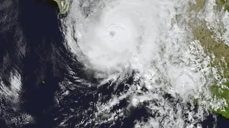
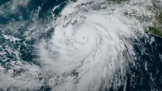
According to the latest IMD bulletins, Cyclonic Storm Akvan is currently located over the Bay of Bengal and is moving in a north-northwestward direction. Forecasters predict it will intensify into a Severe Cyclonic Storm by the evening of November 18
and further into a Very Severe Cyclonic Storm by the morning of November 19. The cyclone is expected to cross the Andhra Pradesh and Yanam coasts, with the probable landfall point between Nellore and Tuni, around noon on November 20. At the time of landfall, the storm is expected to have maximum sustained wind speeds of 120-130 kmph, with powerful gusts reaching up to 145 kmph.
Understanding 130 KMPH Winds
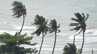
A wind speed of 120-130 kmph places Cyclone Akvan in the 'Very Severe Cyclonic Storm' category according to the IMD's classification scale. These are not just strong winds; they are powerful enough to cause significant destruction. Such speeds can uproot large trees, snap power poles, and cause major damage to kutcha (thatched and mud) houses. Even well-built structures can sustain damage to roofs and siding. The force of the wind can turn loose objects, like tin sheets or unsecured items, into dangerous projectiles. Widespread power outages and disruptions to communication lines are highly likely and could last for several days. The IMD has also warned of a potential storm surge of 1-2 metres above the normal tide, which could inundate low-lying coastal areas in several districts of Andhra Pradesh.
Areas on High Alert
The primary alert is for the coast of Andhra Pradesh, particularly the districts between Nellore and Visakhapatnam, which are directly in the cyclone's path. An orange alert has been issued for the Andhra Pradesh coast and adjoining coastal areas of south Odisha. Heavy to extremely heavy rainfall is predicted for coastal Andhra Pradesh and Yanam on November 19 and 20. The impact will also be felt in neighbouring states. Heavy rainfall warnings have been issued for parts of Tamil Nadu, Odisha, and Telangana. Fishermen have been strongly advised not to venture into the Bay of Bengal, as sea conditions will be extremely rough.
How to Prepare: A Safety Checklist
With the cyclone expected to make landfall soon, preparation is key. Authorities will issue evacuation orders for the most vulnerable areas; follow them without delay. For those sheltering at home, there are crucial steps to take. Secure your house by boarding up or shuttering glass windows. Trim any dead branches or trees close to your home that could fall. Bring loose objects like outdoor furniture, garbage bins, and anything that could be picked up by the wind inside. Prepare an emergency kit with essentials, including a first-aid kit, non-perishable food, bottled water, torches, extra batteries, and any necessary medications. Keep your mobile phones and power banks fully charged. It is also wise to store important documents in waterproof bags. Stay tuned to official updates from the IMD and local authorities, and do not rely on rumours.
What to Do During the Cyclone
Once the cyclone arrives, it is critical to stay indoors in the strongest part of your house, away from windows and doors. An internal room or hallway on the ground floor is often the safest place. Turn off the main electrical supply and the gas regulator to prevent accidents. If the storm's 'eye' passes over, there will be a temporary lull. Do not go outside. The winds will soon return, possibly stronger and from the opposite direction. Continue to monitor official channels for the 'all-clear' signal before venturing out.