


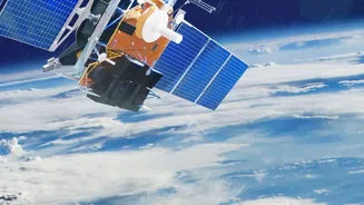


An Orbital Sentry for a Vulnerable Nation
India is no stranger to the fury of nature. Each year, cyclones, floods, landslides, and droughts affect millions of lives and cause extensive damage. For disaster management agencies, the ability to see what is happening on the ground, in real-time,
is crucial. For decades, the Indian Space Research Organisation (ISRO) has been building a formidable fleet of Earth Observation (EO) satellites that act as tireless orbital sentinels. This constellation, which includes the INSAT, Resourcesat, and Cartosat series, provides a synoptic view of the country, capturing vast areas in a single frame and offering data that is impossible to gather quickly from the ground, especially when terrain is inaccessible. These satellites are the backbone of India's modern disaster management strategy, providing critical data for everything from early warnings to post-disaster damage assessment.
The Power of Seeing Through Clouds
One of the biggest challenges in monitoring disasters, particularly during the monsoon season, is persistent cloud cover. Traditional optical satellites, which function like powerful cameras, are often blinded by clouds, rain, and darkness. This is where Radar Imaging Satellites (RISAT) become indispensable. Unlike optical sensors, these satellites use Synthetic Aperture Radar (SAR), a technology that sends out microwave pulses and creates an image from the signals that bounce back. These radar waves can slice through clouds and operate day or night, making them a game-changer for monitoring floods and cyclones. ISRO's RISAT series has been instrumental in providing all-weather surveillance, enabling authorities to create accurate flood inundation maps even during active torrential downpours, a critical component for planning rescue and relief operations.
EOS-05: The Promise of Constant Vigilance
While current satellites are highly effective, most operate in low-Earth orbit, meaning they pass over a specific location only periodically. The next great leap for disaster management is continuous, real-time monitoring. This is the promise of a geostationary imaging satellite, a capability ISRO aims to achieve with its upcoming EOS-05 mission, also known as GISAT-1A. Scheduled for launch on September 4, 2026, EOS-05 will be placed in a high-altitude geosynchronous orbit, allowing it to 'stare' continuously at the Indian subcontinent. This will enable near-real-time imagery of developing weather systems, with the potential to revisit areas of interest in as little as five to thirty minutes. For fast-evolving events like cyclones, forest fires, and flash floods, this constant vigilance would provide an unprecedented advantage, allowing for quicker alerts and more dynamic response strategies. The mission is a fresh attempt to establish this capability after a previous satellite, GISAT-1 (EOS-03), was lost during a launch failure in 2021.
From Satellite Data to Saving Lives
Raw satellite imagery is just the first step; its real value is unlocked when it becomes actionable intelligence. ISRO's National Remote Sensing Centre (NRSC) in Hyderabad is the hub where this transformation happens. During a disaster, the NRSC processes incoming data to create detailed maps showing flood inundation, landslide risk zones, or cyclone paths. These products are then rapidly disseminated to key agencies like the National Disaster Management Authority (NDMA), the India Meteorological Department (IMD), and state-level response forces through dedicated portals like the National Database for Emergency Management (NDEM). This information helps authorities issue timely evacuation orders, deploy resources to the most affected areas, identify safe locations for relief camps, and eventually, assess the extent of damage to crops and infrastructure for recovery efforts.
The Future: An Integrated Sky-High Shield
The launch of EOS-05 represents a pivotal shift towards a more integrated and proactive disaster management framework. The goal is to fuse data from various sources—all-weather radar satellites like RISAT, high-resolution optical satellites like Cartosat, and the new constant-watch capability of geostationary imagers. This will create a multi-layered, comprehensive view of the national landscape. Furthermore, collaborations like the NASA-ISRO Synthetic Aperture Radar (NISAR) mission, which launched in 2025, will provide even more detailed data on Earth's changing surfaces, enhancing our ability to predict and respond to geological hazards like earthquakes and landslides. As India continues to invest in its space infrastructure, these orbital assets are becoming less about technological prowess and more about building a resilient nation, better prepared to protect its citizens from the increasing frequency and intensity of natural calamities.