





A New Eye on Indian Forests
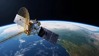
NISAR, which stands for NASA-ISRO Synthetic Aperture Radar, is a state-of-the-art Earth observation satellite. A product of a landmark collaboration between the U.S. and Indian space agencies, its primary mission is to track changes on our planet's surface
with remarkable precision. Scanning nearly the entire globe every 12 days, NISAR provides a consistent and frequent stream of data, allowing scientists to monitor ecosystems, natural hazards, and ice sheets. For India, its capabilities offer a revolutionary tool for managing one of the nation's most precious resources: its forests.
Seeing Through the Canopy
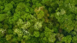
What makes NISAR so special is its advanced radar technology. Unlike optical satellites that rely on sunlight and clear skies, NISAR uses Synthetic Aperture Radar (SAR), which can see through clouds, day and night. Crucially, NISAR is the first mission to use two different radar frequencies together: the L-band (from NASA) and the S-band (from ISRO). Think of it like having two types of vision. The shorter S-band waves interact with the upper and middle parts of the forest canopy, giving a sense of the vegetation structure. The longer L-band waves penetrate deeper, right through the dense leaves and branches, to reveal information about the tree trunks and the ground below. This dual-frequency approach provides a comprehensive, three-dimensional view of the forest that was previously unattainable from space.
Mapping More Than Just Deforestation
When we talk about 'shifts' in forest canopies, it's not just about clear-cutting. NISAR's detailed data allows for the monitoring of more subtle changes. This includes forest degradation, where a forest's density thins out due to selective logging or small-scale fires, a phenomenon often missed by other satellites. It can also track forest regrowth, measure changes in biomass, and assess the health of different forest patches. By repeatedly scanning the same areas, the satellite can detect changes as small as a centimetre, offering insights into everything from the impact of a single storm to long-term climate effects. For example, studies in areas like the Jhilmil Jheel wetland in Uttarakhand have already demonstrated how L-band radar can detect water-logged ground beneath dense forest cover, a crucial capability for monitoring vital wetland ecosystems.
A Game-Changer for Forest Management
This torrent of data is poised to transform how India manages its natural resources. Forest departments will be able to identify areas of illegal logging or encroachment with greater speed and accuracy. The data can help in creating more precise inventories of the nation's carbon stocks, which is essential for meeting climate change goals. Scientists can study the long-term health of diverse ecosystems, from the Himalayan foothills to the Western Ghats and the Sundarbans mangroves. By providing near real-time information, NISAR enables a shift from reactive to proactive forest management. It can pinpoint areas vulnerable to forest fires before they escalate or identify stretches of coastline where mangrove health is declining.