

A New Era of Earth Observation
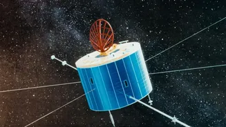
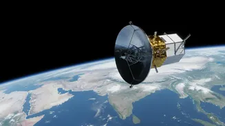
The NASA-ISRO Synthetic Aperture Radar (NISAR) is not just another satellite; it's one of the most sophisticated Earth observation missions ever undertaken. A landmark collaboration between the Indian Space Research Organisation (ISRO) and NASA, NISAR is a testament
to shared scientific ambition. ISRO provided the spacecraft itself, the powerful S-band radar, and the launch vehicle, while NASA contributed the L-band radar and other critical systems. Launched from Indian soil, its primary goal is to systematically map our planet, observing land and ice surfaces with unprecedented detail. For India, this means gaining access to a treasure trove of data that will be crucial for managing everything from agriculture to natural disasters.
Seeing Through Clouds and Darkness
One of the biggest challenges in monitoring floods, especially during the monsoon, is cloud cover. Traditional optical satellites are blinded by clouds, rain, and the dark of night—exactly when flood monitoring is most critical. This is where NISAR's core technology, Synthetic Aperture Radar (SAR), becomes a game-changer. SAR doesn't take pictures in the visible spectrum; instead, it sends out microwave pulses and reads the signals that bounce back. These radar waves slice through clouds, smoke, and darkness, providing a clear, uninterrupted view of the ground below, day or night, in any weather. This capability ensures that response teams get timely and accurate information when they need it most.
The Power of Two Frequencies
NISAR is the first satellite mission designed to use two different radar frequencies simultaneously—L-band and S-band. Think of it as having two distinct ways of seeing the world. The longer wavelength L-band radar, provided by NASA, can penetrate through vegetation canopies like forests and crops. This allows scientists to see the ground surface and detect standing water or saturated soil that would otherwise be hidden. The shorter wavelength S-band radar from ISRO provides finer details about surface texture and vegetation structure. By combining data from both, scientists can create incredibly detailed maps that not only show the extent of a flood but also assess its impact on agriculture and infrastructure with remarkable accuracy.
From Weeks to Days: A Data Revolution
While the headline mentions "daily" releases, the reality is just as revolutionary. NISAR will image nearly the entire planet every 12 days, and with both ascending and descending orbits, it will observe target areas on average every six days. During emergencies, data can be made available within hours. This frequency is a massive leap forward from previous satellites that might take weeks to revisit the same spot. This rapid refresh rate allows for what is called interferometry—comparing two images of the same location taken at different times. This technique is so precise it can detect changes in the ground surface down to a centimetre. For floodplain tracking, this means scientists can measure changes in water level, map the flow of floodwaters, and identify areas of land subsidence with unparalleled speed and precision.
Beyond Response to Resilience
Initially, NISAR's data will dramatically improve emergency response. First responders will have clear maps showing which villages are cut off, what infrastructure is damaged, and where help is most needed. But the long-term impact is even more profound. The consistent, high-resolution data gathered over its multi-year mission will allow scientists to build far more accurate flood models. They can learn how different floodplains behave under stress, monitor the health of wetlands that act as natural buffers, and track changes in Himalayan glaciers and snowpack that feed our major rivers. This knowledge will empower planners to make smarter decisions about land use, infrastructure development, and long-term climate adaptation, building a more flood-resilient India.