





The Monsoon Is Not What It Used To Be
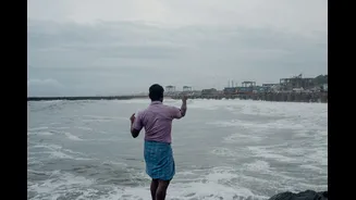
Historically, Chennai's lifeline has been the Northeast monsoon, which delivers the bulk of its annual rainfall between October and December. But historical data shows a worrying shift. Climate change is altering the character of this monsoon. Instead
of prolonged periods of moderate rain, the city is now experiencing shorter, more intense downpours. Studies analysing rainfall patterns over the years reveal that the number of rainy days has decreased, but the intensity of rainfall on the days it does rain has risen sharply. Events like the 2015 floods, where the city received more rainfall in 24 hours than on any day in over a century, are becoming potent examples of this new, aggressive weather pattern amplified by warmer sea temperatures. This shift from steady showers to extreme deluges is at the heart of the city's modern flooding crisis.
An Infrastructure Built for a Bygone Era
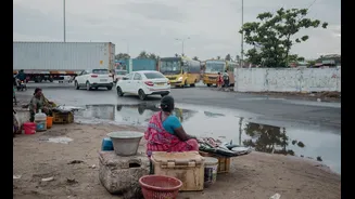
Much of Chennai's road network and its accompanying stormwater drainage system were designed for a different climate reality. This legacy infrastructure was engineered to handle the gentler, more distributed rainfall of the past. Today, it is simply no match for the sudden, high-volume deluges. A Comptroller and Auditor General (CAG) report noted that many drains were built without a proper study of the area's hydrology and topography. Furthermore, despite significant investment in stormwater drains since the 2015 floods, the network remains incomplete. As of 2018, only about a third of the city's 5,500 km road network had accompanying drains. In many areas, drains are built higher than the road, or missing links prevent water from flowing into larger canals, rendering them ineffective during a crisis.
The City That Turned into a Concrete Pan
The problem is not just the rain and the drains; it's the city itself. Decades of rapid, often unplanned, urbanization have transformed Chennai into a vast, impermeable surface. Historically, the region was dotted with over 600 lakes, ponds, and wetlands that acted as natural sponges, absorbing excess rainwater. Today, only a fraction of these water bodies remain, with many having been encroached upon or built over. This rampant development means rainwater no longer seeps into the ground. Instead, it is forced to run off concrete and asphalt surfaces, rapidly overwhelming a drainage system that is already under-resourced and poorly maintained. This 'concrete jungle' effect significantly amplifies the volume and speed of floodwaters on the roads.
Data as a Roadmap for Resilience
While historical data paints a grim picture of increasing vulnerability, it also provides the critical information needed to build a more resilient future. By analysing long-term rainfall patterns, city planners can identify which areas are most at risk and why. This data is crucial for designing smarter infrastructure. Forward-thinking solutions are now being explored and implemented, moving beyond just building more concrete drains. These include restoring lost water bodies to serve as natural retention ponds, implementing 'sponge city' principles with permeable pavements that allow water to soak into the ground, and creating green corridors. Furthermore, technology like real-time flood forecasting systems and sensors in drains can provide early warnings and help manage water flow proactively, turning historical data into a life-saving tool.