





Cosmic Lighthouses as Your Guide
Imagine sailing an endless ocean with no stars, no sun, and no land in sight. This is the reality for spacecraft venturing into deep space, far from the reliable signals of Earth's GPS. NASA's solution is both elegant and futuristic: using pulsars as
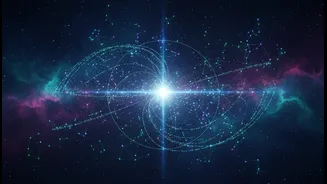
navigational beacons. Pulsars are incredibly dense, rapidly spinning remnants of massive stars. As they rotate, sometimes hundreds of times per second, they emit powerful beams of radiation from their magnetic poles. When these beams sweep past our line of sight, our instruments detect a regular, rhythmic pulse, much like a sailor spotting a lighthouse's beam. The timing of these pulses is so astonishingly precise that some rival the stability of atomic clocks on Earth. This natural, galaxy-spanning network of clocks provides the foundation for what scientists call X-ray pulsar-based navigation and timing (XNAV).
Building a GPS for the Galaxy
The concept is a lot like the GPS in your phone, but on a galactic scale. Your phone triangulates your position by receiving timing signals from multiple satellites orbiting Earth. Similarly, a spacecraft can determine its location by measuring the precise arrival times of signals from several different pulsars. By comparing the observed pulse timings with a pre-loaded database of when those pulses should have arrived, the spacecraft can calculate its position in three-dimensional space. NASA has been actively testing this technology with its Station Explorer for X-ray Timing and Navigation Technology (SEXTANT) experiment aboard the International Space Station (ISS). Using an instrument called NICER, SEXTANT successfully demonstrated that it could autonomously determine the position of the ISS to within a few kilometers, proving the concept is viable.
The 'Image' Is Made of Data
This brings us to the headline's central point. When we hear about a 'pulsar map,' it’s easy to envision a visual chart or a camera taking pictures. However, the reality is more abstract. The instruments used for pulsar navigation, like NICER, are X-ray detectors, not optical cameras. They don't 'see' in the way human eyes do; they count incoming X-ray photons and record their arrival time with incredible precision. The 'map' is not a picture of the pulsar or the space around it. Instead, it’s a vast database of known pulsar locations and their unique timing signatures. The 'image' created by the system is a mathematical solution—a set of coordinates pinpointing the spacecraft's location, derived from processing X-ray data. It’s a map of position, not a visual landscape.
A Key Limit, But Not a Flaw
This distinction is a crucial limitation to understand. A pulsar navigation system cannot show a pilot an incoming asteroid or help a lander 'see' the terrain below it. It is a positioning system, pure and simple. Its job is to answer the question, "Where am I?" not "What is in front of me?" This is not a flaw in the design but a fundamental aspect of the technology. For deep space missions, which currently rely on a constant, time-delayed conversation with tracking stations on Earth, this is revolutionary. It grants spacecraft autonomy. A mission to Mars or the outer planets could navigate in real-time without phoning home, allowing for more complex maneuvers and reducing the strain on Earth's deep space communication networks.
The Future of Autonomous Exploration
The pulsar map complements, rather than replaces, other navigational tools. A deep space vehicle of the future will likely use a suite of instruments. It would use pulsar navigation to determine its absolute position on the vast map of the solar system, while optical cameras and radar would be used for proximity operations like docking, landing, or avoiding hazards. The development of pulsar navigation is about breaking our reliance on Earth-based guidance for deep space travel. As missions become more ambitious, venturing farther and for longer periods, the ability for a spacecraft to know its own location autonomously becomes essential. The Lighthouse Pulsar Map might not provide a scenic view, but it offers something far more valuable: a reliable path through the void. It’s the key to transforming our spacecraft from tethered explorers into truly independent voyagers.