







The Basic Engine: Land and Sea
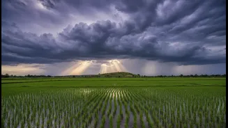
At its heart, the monsoon is driven by a simple temperature difference. In the summer, the vast landmass of the Indian subcontinent and the Tibetan Plateau heats up much faster than the surrounding Indian Ocean. This creates a low-pressure area over the land,
which acts like a giant vacuum, pulling in moisture-laden winds from the cooler, high-pressure zone over the ocean. This seasonal wind reversal is the fundamental engine that powers the monsoon, driving a massive flow of moist air inland, which then rises, cools, and releases torrential rain.
The Pacific's Powerful Pull: El Niño and La Niña
Thousands of kilometres away, the Pacific Ocean plays a powerful role in the monsoon's fate. This is through a phenomenon called the El Niño-Southern Oscillation (ENSO). During an El Niño year, the surface waters of the central and eastern Pacific Ocean become unusually warm. This disrupts global atmospheric circulation, often leading to weaker monsoon winds and reduced rainfall over India. Conversely, its counterpart, La Niña, involves a cooling of the same ocean waters. La Niña conditions typically have the opposite effect, often enhancing monsoon rainfall and leading to a wetter season across the subcontinent. While the link is strong, it's not guaranteed; some El Niño years have still produced average or above-average rainfall, showing other factors are at play.
The Indian Ocean's Own Climate Seesaw
The Indian Ocean has its own climate pattern, known as the Indian Ocean Dipole (IOD), which can either amplify or counteract El Niño's influence. The IOD, sometimes called the 'Indian Niño', refers to the temperature difference between the western Indian Ocean near Africa and the eastern Indian Ocean near Indonesia. During a 'positive' IOD phase, the western part of the ocean becomes warmer than the east. This pushes more moisture-filled air towards India, often boosting the monsoon. A strong positive IOD has been known to offset the drought-inducing effects of an El Niño, as seen in 1997. A 'negative' IOD does the reverse, weakening the monsoon and sometimes worsening drought conditions when it coincides with an El Niño.
The Tropical Rain-Maker: Madden-Julian Oscillation
Another key player is the Madden-Julian Oscillation (MJO), an eastward-moving pulse of clouds, rainfall, and wind that circles the tropical parts of the globe every 30 to 60 days. Unlike El Niño, which operates over months, the MJO influences weather on a shorter timescale. When the MJO is in its active phase over the Indian Ocean, it can enhance convection and trigger heavy rainfall, often playing a crucial role in the onset of the monsoon or causing intense rainy spells during the season. Its suppressed phase, by contrast, can lead to 'breaks' in the monsoon with little rainfall. The MJO is a major reason for the intra-seasonal ebbs and flows of monsoon rainfall.
The Complication of Climate Change
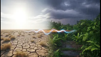
Overlaying these natural cycles is the growing influence of global warming. Climate change is making the monsoon more erratic and intense. While warmer air can hold more moisture, potentially leading to an increase in total rainfall, it also changes circulation patterns. Experts note that climate change is intensifying rainfall when it does occur, even as patterns like El Niño might delay its onset. This leads to a more chaotic monsoon, with long dry spells punctuated by extreme rainfall events, increasing the risk of both droughts and floods. This new reality presents a significant challenge for agriculture and water management across India.