






An Eye in the Sky for India's Oceans
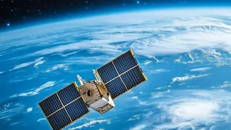
The OceanSat programme is a series of Earth observation satellites built and operated by the Indian Space Research Organisation (ISRO) specifically for oceanography and atmospheric studies. The journey began with OceanSat-1, launched in 1999, followed
by OceanSat-2 in 2009. The latest in the series, EOS-06, also known as OceanSat-3, was launched in November 2022 to provide continuity and enhanced services. These satellites orbit the Earth, equipped with advanced instruments designed to monitor our seas in ways impossible from the surface. Their primary mission is to gather data on ocean colour, sea surface temperature, and surface winds, providing crucial inputs for a wide range of applications that directly impact the nation.
Guiding Fishermen to a Better Catch
One of OceanSat's most celebrated applications is its ability to guide fishermen to resource-rich areas. The satellites don't track fish directly. Instead, they find the 'restaurants' where fish are likely to be feeding. This is achieved with the Ocean Colour Monitor (OCM), a key instrument on the satellites. The OCM detects the concentration of chlorophyll in the water, which indicates the presence of phytoplankton—the base of the marine food web. Areas with high chlorophyll content are fertile grounds for fish. By identifying these Potential Fishing Zones (PFZ), ISRO provides invaluable intelligence to India's fishing community.
From Satellite Data to Daily Alerts
The data collected by OceanSat is downlinked and processed by the Indian National Centre for Ocean Information Services (INCOIS). INCOIS analyses the satellite inputs on chlorophyll and sea surface temperature to generate daily PFZ advisories. These are not just complex maps; they are simple, actionable alerts that provide coordinates, depth, and the distance and direction from known coastal landmarks. To ensure maximum reach, these advisories are disseminated in local languages through a multitude of channels, including websites, mobile apps, SMS, and community radio, reaching hundreds of thousands of fishermen. This service saves fishermen enormous amounts of time and diesel that would otherwise be spent searching aimlessly, making their operations more profitable and sustainable.
An Early Warning System for Cyclones
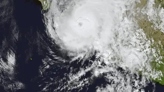
Beyond its role in supporting livelihoods, the OceanSat series is a critical tool for saving lives. The satellites are equipped with a scatterometer, an instrument that measures the speed and direction of winds over the ocean's surface. This data is fundamental for weather forecasting, especially for the early detection and tracking of cyclones. The scatterometer can identify the formation of cyclonic systems, monitor their intensification, and help predict their path. This gives disaster management authorities precious lead time to issue warnings and evacuate coastal populations, significantly reducing the potential for devastation along India's 7,500-kilometre coastline.
A Legacy of Protection and Prosperity
The dual-use nature of the OceanSat program showcases the profound impact of India's space technology. The same satellite that helps a fisherman increase his catch also provides the critical weather data that warns him of an approaching storm. This synergy between economic empowerment and public safety is at the heart of the programme's success. The data from OceanSat contributes to a wide array of climate and oceanographic studies, from monitoring sediment dynamics to understanding the role of oceans in climate change. It represents a powerful system where technological prowess is directly linked to national well-being, protecting both the lives and the livelihoods of millions of Indians dependent on the sea.