



Reading the Rainbow of the Sea
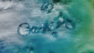
At its heart, the technology doesn’t see fish directly. Instead, it sees their food. The colour of the ocean changes based on what's in it. Water that is rich in phytoplankton—microscopic marine algae—appears greenish. Since phytoplankton form the base of the marine food web,
their presence indicates a thriving ecosystem. These tiny plants are the primary food source for small fish, which in turn attract larger, commercially valuable fish. By identifying areas with high concentrations of phytoplankton, scientists can pinpoint zones where fish are likely to gather. The key ingredient they look for is chlorophyll, the pigment that phytoplankton use for photosynthesis. More chlorophyll means more phytoplankton, which signals a potential hotspot for fishing.
ISRO's Eyes in Orbit
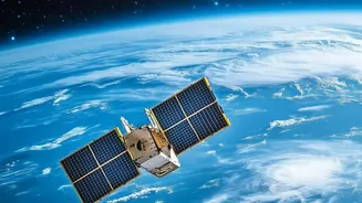
This is where the Indian Space Research Organisation's (ISRO) OceanSat series of satellites come in. Starting with Oceansat-1 in 1999 and continuing with Oceansat-2 (2009) and the latest EOS-06, also known as Oceansat-3 (2022), these satellites are equipped with a crucial instrument: the Ocean Colour Monitor (OCM). The OCM is a highly sensitive camera that can detect subtle variations in the colour of the ocean across multiple spectral bands. The latest OCM-3, for instance, has 13 different channels, allowing it to gather highly detailed data on chlorophyll concentration on a global scale. This data provides a comprehensive picture of where the building blocks of the marine food chain are located.
Creating the Treasure Map
The raw data from the OceanSat's OCM is just the first step. This information is sent to the Indian National Centre for Ocean Information Services (INCOIS) in Hyderabad. There, scientists combine the chlorophyll data with other crucial satellite measurements, most importantly sea surface temperature (SST). Fish are sensitive to temperature and tend to congregate in areas where the water temperature is ideal. By layering the chlorophyll data with SST maps, scientists can identify what are known as Potential Fishing Zones (PFZs). These PFZs are, in essence, treasure maps for fishermen, marking the most probable locations of fish aggregation on any given day.
From Satellite to Smartphone
Generating the PFZ advisories is only useful if the information reaches the fishermen in time. INCOIS has developed a robust system to disseminate these maps. The advisories are translated into regional languages and sent out through various channels, including mobile apps like 'Samudra', text messages, and electronic display boards at fishing harbours. For fishermen venturing far from shore beyond the reach of mobile networks, ISRO has also helped develop specialised low-cost devices like GEMINI (Gagan Enabled Mariner’s Instrument for Navigation and Information). These devices use satellite communication to deliver PFZ advisories and safety alerts, ensuring fishermen are both efficient and safe.
A Revolution for Indian Fisheries
The impact of this technology on India's fishing community has been transformative. Fishermen report a significant reduction in searching time, which leads to massive savings on fuel—a major operational cost. Studies have shown that using PFZ advisories can cut search times by 30% to 70%. This not only increases profitability but also reduces the carbon footprint of the fishing fleet. The catch per trip is often higher in the identified zones, leading to better income and more reliable livelihoods for lakhs of fishermen. It allows for more efficient fishing, not necessarily more fishing, which contributes to more sustainable practices by reducing wasted effort and fuel.
More Than Just Fishing
The applications of ocean colour technology extend far beyond just guiding fishing boats. The same data from the Ocean Colour Monitor helps scientists monitor the overall health of marine ecosystems. It is used to track harmful algal blooms, which can be toxic to marine life and impact aquaculture. It also helps in studying sediment movement in coastal zones, understanding ocean currents, and even contributing to climate change research by measuring how much carbon is being absorbed by ocean phytoplankton. This makes ISRO’s OceanSat program a vital tool not just for the economy, but for the environmental stewardship of India’s vast coastline.