


A Welcome Break in Purvanchal
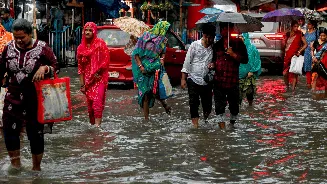
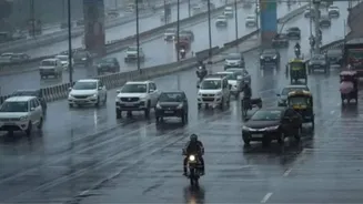
Residents across the Purvanchal region of eastern Uttar Pradesh are finally experiencing relief from a relentless heatwave. Over the past few days, scattered, localized rainfall has led to a noticeable drop in daytime temperatures. Before the showers,
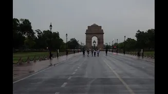
cities like Prayagraj and Varanasi saw mercury levels consistently hover above 40 degrees Celsius, with Prayagraj recently recording a high of 43.4 degrees Celsius. [14] While the rain has not been widespread across the entire state, its arrival in districts in the eastern part of UP has been celebrated by locals who have been enduring oppressive heat and humidity for weeks. Even in areas like Lucknow, which saw overnight thunderstorms, the accompanying rise in humidity to over 80% meant the relief was short-lived and the feeling of heat persisted. [14]
The Science Behind the Showers
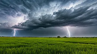
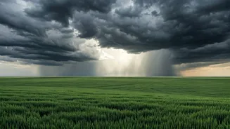
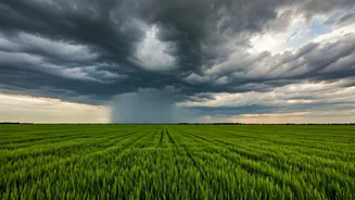
The current rainfall is classified as pre-monsoon activity. These are not yet the sustained, widespread rains of the Southwest Monsoon. According to the India Meteorological Department (IMD), these showers are a result of atmospheric instability caused by the intense ground-level heat meeting moisture-laden winds. [10] A trough, which is an elongated area of low pressure, has become active from eastern Uttar Pradesh towards Chhattisgarh, creating favorable conditions for thunderstorms, gusty winds, and light rain. [10] This activity is a common precursor to the main monsoon season, providing a temporary cooldown before the larger weather system establishes itself over the region.
Relief, But the Heatwave Lingers
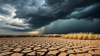
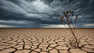
While the showers have brought down temperatures in specific localities, the IMD has been clear that the danger of heatwave conditions has not entirely passed. Severe heatwave conditions have gripped various parts of Uttar Pradesh for much of June, with temperatures in some areas, like Banda, previously reaching nearly 47 degrees Celsius. [10] The IMD had issued warnings for severe heatwave conditions to continue in parts of East UP through June 28th and 29th, even as it forecast thunderstorms in other isolated pockets. [2, 6] This mixed forecast highlights the transitional nature of the current weather pattern, where intense heat can coexist with developing storm systems.
What Does This Mean for the Monsoon?
The critical question for everyone is: when will the proper monsoon arrive? The Southwest Monsoon's progress has been a topic of daily conversation. As of June 28th, the Northern Limit of Monsoon—the leading edge of the system—was still to the east, passing through Bihar. [2] The monsoon's arrival in UP is officially delayed; it typically enters the state around June 18th. [14] However, the IMD has stated that conditions are becoming favorable for its further advance. The current forecast suggests that the monsoon could enter Uttar Pradesh within the next two to three days, with a new spell of more significant and widespread rain expected to begin around June 30th or in the first week of July. [7, 8, 12] This suggests the current showers are just an appetizer for the main course that is soon to arrive.
Impact on Daily Life
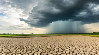
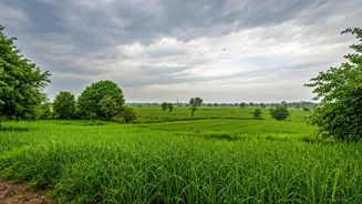
The prolonged heatwave has had a significant impact on daily life, forcing people to remain indoors during the hottest parts of the day and putting vulnerable populations at risk of heat-related illnesses. [16] The arrival of these pre-monsoon showers brings more than just a temperature drop; it brings a psychological boost. It signals the approaching end of the harshest summer period. For the agricultural sector in the region, the rain is critical. It provides initial moisture for parched fields ahead of the main sowing season that accompanies the monsoon. While this temporary relief is welcome, the entire region remains in a state of anticipation, eagerly awaiting the full, life-giving embrace of the Southwest Monsoon.