






The familiar dread of a cyclone warning is intensifying. The recent arrival of Cyclones Arnab and Murasu, which struck the same coastline within a week, has moved the conversation beyond immediate damage to a much larger, more troubling question.
A Rare and Rapid Succession
The occurrence
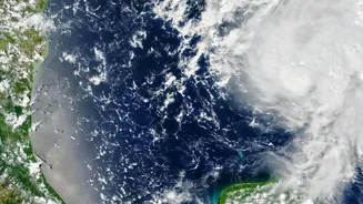
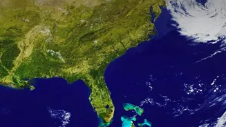
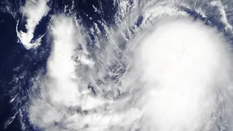
of two severe cyclonic storms hitting the same coastal region in such a short span is a rare event. Cyclone Arnab made landfall along the Andhra Pradesh coast around October 28, causing significant damage and loss of life in the state as well as in neighbouring Odisha. Before communities could fully recover, Cyclone Murasu formed in the Bay of Bengal and struck the Andhra coast again around November 3. While back-to-back storms are not unprecedented, this rapid succession has focused scientific and public attention on whether this is part of a new, more dangerous pattern for India’s coasts. Satellite imagery revealed that while both storms followed a similar path, they had different structures, with Arnab being more sprawling and Murasu appearing more compact and intense just before landfall.
The Real Change: Intensity and Speed
The primary concern for scientists is not necessarily an increase in the total number of cyclones, but a clear trend towards greater intensity and rapid intensification. This phenomenon, where a storm strengthens from a weak cyclone to a very severe one in less than 24 hours, is being observed more frequently. This was seen with Cyclone Arnab, which underwent rapid intensification before it hit the coast. This acceleration is fueled by warmer sea surface temperatures, which act like a high-octane fuel for storms. The North Indian Ocean has seen significant warming, providing the heat and moisture that are the essential ingredients for powerful cyclones.
A Tale of Two Seas
Historically, the Bay of Bengal has been India’s cyclone hotspot, responsible for the vast majority of storms. While the Bay continues to produce very severe storms, a significant and alarming trend is emerging in the Arabian Sea. Once considered relatively calm, the Arabian Sea has seen a more than 50% increase in the frequency of cyclones in recent decades, with a 150% rise in very severe cyclones. The total duration and accumulated energy of cyclones in the Arabian Sea have also increased dramatically. This shift means that India's western coast, from Gujarat to Kerala, now faces a threat level that was previously associated almost exclusively with the east coast.
The Climate Change Connection
The link between these changing patterns and climate change is becoming undeniable. Recent studies are now able to attribute specific damages to the influence of a warmer climate. A study by researchers at Imperial College London concluded that climate change increased the direct economic damage from Cyclone Arnab by 33%. The study found that warming contributed to a 5% increase in wind speed and an 11% increase in rainfall intensity, which together led to a disproportionately larger increase in damage. This moves the issue from a hypothetical future risk to a measurable cost being paid by coastal communities today.
The Forecasting Challenge
Despite a clearer understanding of the long term trends, predicting the exact behaviour of an individual storm remains a profound challenge. The India Meteorological Department (IMD) has made great strides in forecasting the track of cyclones, which has been crucial in saving lives through timely evacuations. However, forecasting rapid intensification is still a major hurdle for weather models globally. This is why initial forecasts might underestimate a storm's eventual power, and why alerts can change so quickly. The headline's point about not predicting specific landfalls speaks to this uncertainty; while we know where a storm is generally headed, its final intensity and precise point of impact can evolve rapidly, complicating preparedness on the ground.