


The Peril of the Hills
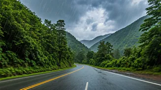
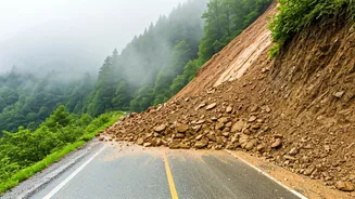
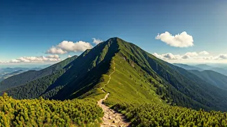
Anyone who has driven through the Himalayas or the Western Ghats knows the feeling. The stunning beauty of the landscape is matched only by its potential danger. A sudden downpour can trigger a landslide, washing away a section of the road in minutes.
A minor accident can cause a multi-hour jam on a narrow pass with no alternate routes. Official information, while crucial, often struggles to keep pace with the rapidly changing conditions on the ground. For years, the primary source of real-time information was word-of-mouth from returning drivers or local shopkeepers—an unreliable and often outdated system.
Enter Collaborative Mapping
This is where collaborative mapping tools have become game-changers. Platforms like Google Maps and Waze are no longer just for navigating from Point A to Point B. They have evolved into live, dynamic maps powered by their own users. The concept is simple but powerful: every driver using the app acts as a real-time sensor on the road. By passively sharing their location and speed data, and actively reporting hazards, they contribute to a constantly updated picture of the road network. This crowdsourced information is then instantly shared with every other user in the area, creating a digital safety net.
How Your Report Helps Everyone
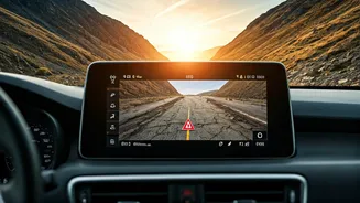
The process is remarkably straightforward. When a driver encounters a hazard—a landslide, a fallen tree, a major pothole, or an accident—they can report it with a few taps on their app. For instance, on Google Maps, you can tap the ‘Report’ icon and select the type of incident. The app then uses an algorithm to verify the report. If multiple users in the same location report a similar issue, or if traffic data shows a sudden, unexplained stop, the system flags the location with a warning icon for all other drivers. This turns a single driver's observation into a collective warning, potentially preventing hundreds of others from driving into a dangerous situation or a dead-end.
Beyond Just Traffic Jams
While these tools are famous for helping commuters beat city traffic, their application in hilly terrains is far more critical. The warnings are not just about slowdowns; they are about immediate physical dangers. During the intense monsoon season in states like Uttarakhand and Himachal Pradesh, these apps have become indispensable. Users report ‘Road Closed’ due to landslides, allowing others to reroute before they get stuck for hours. Alerts for ‘Object on Road’ can warn a driver rounding a blind curve about a fallen boulder. By providing this hyper-local, real-time intelligence, the apps empower drivers to make informed, safer decisions on roads where conditions can change in an instant.
The Power of a Connected Community
Ultimately, the success of collaborative mapping is a story about community. It’s a digital version of drivers flashing their headlights to warn oncoming traffic of a police check, but on a massive, automated scale. Every report is an act of civic-mindedness, a small contribution that enhances the collective safety of everyone on the road. It transforms the solitary, often anxious, experience of a hill drive into a connected one, where a network of unseen fellow travellers is constantly looking out for you. This is particularly vital in a country as vast and geographically diverse as India, where centralised monitoring of every remote road is a logistical impossibility.
The Road Ahead
The system isn't without its challenges. Its effectiveness depends on network connectivity, which can be patchy in remote mountain areas. It also relies on a critical mass of users to provide and verify data. A lone driver on an isolated road won't benefit as much. However, as smartphone penetration deepens across India, these networks are only becoming more robust. The future may see even greater integration, with data from these public platforms being fed directly to official disaster management agencies, creating a powerful synergy between citizen reporting and government response.