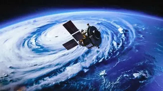








A Constant Watch for Disasters
Unlike previous satellites that passed over an area periodically, EOS-05 is in a geosynchronous orbit, meaning it stays over the Indian subcontinent continuously. This is a game-changer for disaster management. Imagine getting near real-time updates on a developing
cyclone in the Bay of Bengal, or tracking the spread of forest fires as they happen. The satellite can provide images of a specific area every five minutes. This constant monitoring allows authorities to issue faster, more accurate warnings for cyclones, floods, and landslides, giving communities crucial time to prepare and evacuate, ultimately saving lives.
Smarter, More Resilient Farming
Agriculture remains the backbone of the Indian economy, and EOS-05 is set to become a vital tool for farmers. The satellite's advanced sensors can monitor crop health, assess soil conditions, and track water resources over vast areas. By providing near real-time data on large-scale agricultural trends, it supports government programs like crop yield forecasting and drought monitoring. This information helps in making better policy decisions, managing water resources more efficiently, and providing farmers with advisories that can lead to better harvests and greater food security for the nation.
Strengthening National Security
A nation's security relies on its ability to monitor its borders and maritime interests. EOS-05 provides a significant strategic advantage by offering persistent surveillance of the Indian subcontinent and its surrounding oceans. Its ability to 'hover' over a region allows for continuous monitoring of sensitive border areas and vital assets, day and night. This 'eye in the sky' enhances India's defence capabilities by providing a constant stream of high-resolution imagery for strategic applications, helping to safeguard the country's vast land and sea frontiers.
Guarding Forests and Water Sources
The health of our environment is critical for our future, and EOS-05 plays a key role in its protection. The satellite's hyperspectral and multispectral imagers can track changes in our natural resources with incredible detail. This includes monitoring the health of forests, detecting illegal deforestation, tracking the retreat of Himalayan glaciers, and managing our precious water bodies. This comprehensive environmental data is essential for sustainable development, helping policymakers create effective strategies to combat climate change and preserve India's natural heritage for future generations.
Building the Cities of Tomorrow
As India's urban centres continue to expand rapidly, smart planning is more important than ever. High-resolution, continuous imagery from satellites like EOS-05 can be invaluable for urban planners and administrators. This data can be used to monitor urban sprawl, plan for new infrastructure projects like roads and public transport, and ensure that development is sustainable. By providing a detailed, bird's-eye view of how our cities are growing and changing, the satellite helps create urban environments that are more efficient, liveable, and resilient.