



The Challenge of Seeing the Forest for the Trees
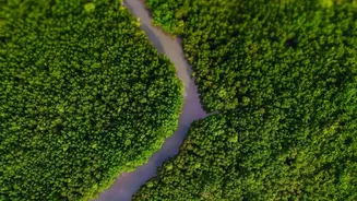
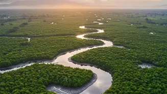
The Sundarbans, the world's largest mangrove forest, is a complex, sprawling, and often inaccessible landscape of tidal waterways and dense vegetation. For decades, its immense value as a carbon sink—a natural environment that absorbs more carbon than
it releases—was understood, but difficult to quantify precisely. Traditional methods of measuring forest biomass and carbon storage involve painstaking fieldwork, which is nearly impossible to conduct at scale in such a challenging environment. Scientists have long known that these 'blue carbon' ecosystems, which include mangroves, are exceptionally efficient at sequestering carbon, storing up to four times more per hectare than most terrestrial forests. The challenge has been to accurately measure this storage across the entire 10,000-square-kilometre forest that straddles India and Bangladesh, and to track how it changes over time, especially in areas targeted for restoration. Without clear data, it's hard to verify the success of conservation projects or make the case for further investment.
An Eye in the Sky Changes Everything
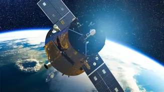
A new generation of satellite technology is revolutionising this process. By combining high-resolution optical imagery with advanced radar systems, like those used by the joint US-Indian satellite NISAR, scientists can now see beyond the leafy canopy. These technologies can penetrate cloud cover and darkness, providing a consistent and detailed view of the forest's structure. Using platforms like Google Earth Engine, researchers apply machine learning algorithms to this torrent of data from satellites like Sentinel-1 and Sentinel-2. This allows them to estimate not just the area of mangrove cover, but the aboveground biomass—the total mass of the trees—with remarkable accuracy. From this, they can calculate the total amount of carbon being stored, providing clear, quantifiable insights that were previously out of reach.
Validating Years of Restoration Work
The data streaming back from these orbital platforms is delivering powerful news: restoration efforts are working. Projects launched by organisations and local communities to replant mangroves in degraded areas are yielding measurable results. One project started in 2011, for example, has seen the restoration of over 5,000 hectares of mangroves, which will store an estimated 700,000 tonnes of CO2 equivalent over 20 years. The new satellite monitoring provides independent verification of these successes. Studies have shown a significant increase in deep forest cover in recent years. This data is crucial because it proves that investing in mangrove restoration provides a tangible return in the fight against climate change. It also supports local communities, as healthy mangroves revive fisheries, protect against storm surges, and create sustainable livelihoods like honey collection.
The Future of Blue Carbon Finance
This ability to accurately measure, report, and verify (MRV) carbon sequestration is a game-changer. It unlocks the potential for the Sundarbans to access global climate finance markets. Nations and corporations looking to offset their emissions can purchase 'carbon credits' from projects that can prove they are effectively removing carbon from the atmosphere. The new satellite data provides the robust evidence needed to generate these credits, potentially channelling significant funding into the conservation and expansion of the Sundarbans. This creates a virtuous cycle: successful restoration, proven by technology, attracts funding that allows for even more restoration. This approach aligns nature conservation with economic benefits, ensuring the long-term protection of the ecosystem and the communities that depend on it.