





A Deceptive Calm After the Surge
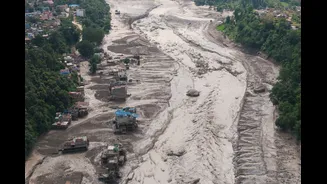
The immediate aftermath of a flash flood, like the one that recently devastated areas along the Nepal-Tibet border, can be misleading. As the initial wall of water that tore through the Bhote Koshi and Trishuli river corridors passes, water levels may
drop, creating a false sense of security. However, this is a critical time for disaster management officials and hydrologists. The initial event, often triggered by a glacial collapse or extreme rainfall, dramatically alters the landscape, setting the stage for subsequent, equally dangerous events. Authorities continue to urge residents near riverbanks to remain in safer locations, aware that the situation is far from stable.
Saturated Ground: A Sponge at its Limit
One of the most significant unseen dangers is soil saturation. After days of heavy monsoon rainfall, the ground becomes like a sponge that can’t absorb any more water. This has two major effects. First, any additional rainfall, even moderate showers, will not seep into the earth. Instead, it immediately runs off the surface, which can trigger new flash floods with terrifying speed. This phenomenon, known as pluvial flooding, is why urban areas like Kathmandu can flood after just a few hours of rain, but it’s even more dangerous in the mountains. Second, this waterlogged ground loses its structural integrity, making entire hillsides unstable. The weather forecast remains a key concern, with more monsoon rain expected across several provinces, keeping the ground saturated and the risk elevated.
The Compounding Threat of Landslides
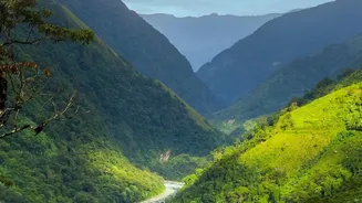
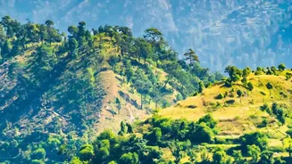
In Nepal's mountainous terrain, saturated ground is a precursor to landslides. The combination of steep slopes and water-weakened soil means that hillsides can give way without warning, sending tonnes of rock, mud, and debris crashing into valleys below. This poses a dual threat. A landslide can directly bury homes and infrastructure, but it can also create a new, even more catastrophic flood risk. When a landslide falls into a river, it can form a temporary dam, blocking the water's flow. Water builds up behind this unstable barrier until the pressure becomes too great, and the dam bursts, releasing a sudden, massive wave of water and debris downstream—an event known as a Landslide Dam Outburst Flood (LDOF). Experts have been watching for exactly this kind of lingering blockage.
A Remodelled and Unpredictable River
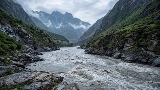
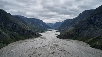
A major flood doesn't just pass through a river channel; it completely re-engineers it. The immense force of the water carves new paths, erodes banks, and deposits vast quantities of sediment, boulders, and debris, including wreckage from destroyed homes and bridges. This raises the riverbed, reducing the channel's capacity to hold water. As a result, even a normal volume of water can now cause the river to overflow its banks in unpredictable locations. What was once a safe distance from the river may no longer be. Hydrologists at Nepal's Department of Hydrology and Meteorology closely monitor water levels, but the changed river dynamics make forecasting more challenging. The recent flood was so powerful that water levels in the Trishuli river reportedly rose by nine meters in just half an hour.
What Experts Are Watching Now
In the wake of the initial disaster, a multi-faceted monitoring effort is underway. Experts are using a combination of satellite imagery, weather forecasts, and on-the-ground data. They are looking for signs of new landslide dams forming upstream in remote, often inaccessible areas. River gauges, where they haven't been washed away, provide real-time data on water levels and flow rates. Weather radar and forecasts are critical for anticipating where the next downpour might hit and how it will impact the already saturated ground. Nepal's Flood Forecasting Division has been analyzing the situation, reassuring the public that while rumours of a larger flood are currently unsubstantiated, the risk from further rainfall remains real and requires vigilance.