






The Challenge of Predicting a Downpour
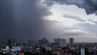
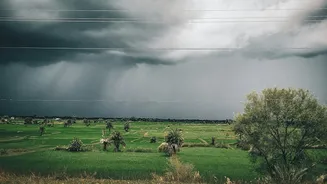
Sudden, heavy rainfall, often called a cloudburst or a flash flood trigger, happens over a small area and develops rapidly. Traditional weather models are excellent at forecasting large-scale systems like monsoons or widespread cyclonic rain, but they
can struggle to capture these small, fast-moving events. Predicting that it will rain over a city is one thing; predicting a deluge over a specific neighbourhood in the next hour requires a different set of tools. This is where the constant watch of meteorological satellites becomes indispensable, providing a real-time view of the atmosphere from above.
An Eye in the Sky: India's Satellite Guardians
To monitor the vast and dynamic Indian subcontinent, the India Meteorological Department (IMD) relies on a series of geostationary satellites, most notably the INSAT-3D and INSAT-3DR. Positioned thousands of kilometres above the Earth, these satellites provide a continuous stream of data, sending back high-resolution images of the cloud cover over India every 15 to 30 minutes. This constant vigilance is key to 'nowcasting'—the science of forecasting weather for the immediate few hours, which is crucial for issuing timely alerts for extreme events. Among the wealth of data they provide, one of the most critical measurements is cloud-top temperature.
Why Colder Cloud Tops Mean Heavier Rain
The relationship between cloud-top temperature and rainfall intensity is a fundamental principle of meteorology. Intense rainfall comes from tall, towering cumulonimbus clouds, the same clouds that produce thunderstorms. These clouds form when warm, moist air near the surface rises rapidly in a process called convection. As this air parcel shoots upward into the atmosphere, it expands and cools, causing water vapour to condense into cloud droplets and eventually ice crystals. The more powerful the updraft, the higher the cloud will grow. Since the upper atmosphere is extremely cold, a taller cloud will have a colder top. Therefore, very cold cloud-top temperatures—often seen as bright white or enhanced colours on satellite imagery—are a tell-tale sign of a deep, vertically developed cloud packed with moisture and energy, primed to release a large amount of precipitation.
From Data to Warning
Meteorologists don't just look for cold clouds; they look for clouds that are getting colder, fast. A rapid drop in the cloud-top temperature measured by a satellite's infrared sensors indicates that a storm is intensifying quickly. Analysts at the IMD use specialised tools to process the gigabytes of data streaming from INSAT-3DR, looking for these patterns. They identify cloud systems where the tops have cooled below a certain threshold, indicating strong convection. By tracking the movement and evolution of these cold cloud tops, forecasters can estimate where the heaviest rain is likely to fall and issue specific, short-term warnings for districts and even smaller areas.
The Future of Forecasting: AI and Better Models
While satellite data is a powerful tool, it isn't perfect. It provides a top-down view, which is then combined with ground-based radar, which detects raindrops within the cloud, and on-ground weather stations for a complete picture. There can be a lag between when the satellite sees the storm intensify and when the heaviest rain begins. The next frontier in this field involves integrating artificial intelligence (AI) and machine learning. Researchers are developing models that can analyse vast amounts of historical satellite data and weather parameters to learn the subtle signatures that precede a cloudburst. By recognising these complex patterns, AI-driven systems aim to make predictions faster and even more accurate, giving communities more precious time to prepare for nature's fury.