


India's Eyes in the Sky
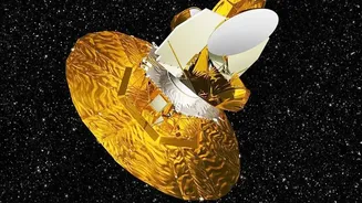
At the heart of this agricultural revolution is the Indian Space Research Organisation (ISRO). Using a constellation of earth observation satellites, ISRO provides a continuous stream of data that is changing how farming is managed. Key among these are
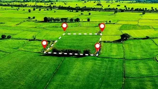
the Resourcesat, Cartosat, and RISAT series of satellites. Unlike optical satellites, which can be blocked by monsoon clouds, RISAT (Radar Imaging Satellite) uses synthetic aperture radar (SAR) that can see through cloud cover and rain, making it indispensable during the Kharif season. This technology, known as remote sensing, allows scientists to monitor vast stretches of farmland without ever setting foot on the ground, capturing information on everything from crop health to soil moisture.
From Sowing to Forecasting
Satellite technology assists farmers and policymakers through every stage of the cropping cycle. Before sowing, satellite data helps assess soil moisture levels, guiding farmers on the optimal time to plant. As crops grow, satellites measure their health using indicators like the Normalized Difference Vegetation Index (NDVI), which analyses the greenness of plants. This can reveal early signs of stress from pests, diseases, or nutrient deficiencies long before they are visible to the naked eye. This information is crucial for programs like FASAL (Forecasting Agricultural output using Space, Agro-meteorology and Land-based observations), which provides pre-harvest production forecasts for major crops like rice and wheat. Run by the Mahalanobis National Crop Forecast Centre (MNCFC), this initiative integrates satellite data with weather and ground observations to generate accurate estimates of crop acreage and yield.
Taming the Monsoon's Extremes
The monsoon season often brings the dual threats of floods and droughts. Satellite remote sensing has become a critical tool for disaster management. By providing near real-time imagery, satellites allow authorities to quickly map the extent of flood-inundated areas, enabling faster response and damage assessment. Similarly, programs like the National Agricultural Drought Assessment and Monitoring System (NADAMS) use satellite data to provide early warnings of drought conditions. By tracking rainfall patterns, vegetation health, and soil moisture, officials can identify drought-stressed regions and implement mitigation measures, such as adjusting irrigation schedules or providing aid.
Data Delivered to the Farm
Collecting data is only half the battle; getting it into the hands of farmers is what makes a difference. This is where platforms like ISRO's Bhuvan geoportal come in. Bhuvan provides a wide range of agricultural information, from crop monitoring to pest surveillance. Government initiatives and agritech startups are also developing mobile apps that translate complex satellite data into simple, actionable advice for farmers. These apps can provide location-specific recommendations on irrigation, fertiliser use, and pest management, empowering even smallholder farmers in remote areas to make data-driven decisions.
Strengthening Food Security and Insurance
The impact of this technology extends to the national economy and farmer security. More accurate yield forecasts help the government make better policy decisions regarding food storage, distribution, and trade. Furthermore, satellite data is revolutionising crop insurance under the Pradhan Mantri Fasal Bima Yojana (PMFBY). Insurers are using satellite imagery to verify claims of crop damage from floods or droughts, leading to faster and more transparent claim settlements. Initiatives like YES-TECH (Yield Estimation System based on Technology) use satellite-based models to estimate yields at the Gram Panchayat level, reducing the reliance on manual surveys and helping to resolve disputes over insurance payouts.