








Understanding the Monsoon Hazard Map
During the monsoon, certain parts of India are far more vulnerable to landslides than others. The two primary high-risk zones are the Himalayas and the Western Ghats. Geologically young and tectonically active, the Himalayan states—including Himachal
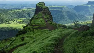
Pradesh, Uttarakhand, and parts of Jammu and Kashmir—see the majority of India's landslides. The steep slopes, combined with heavy rainfall and frequent seismic tremors, create a perfect storm for slope failure. Similarly, the Western Ghats, which stretch through Maharashtra, Goa, Karnataka, Kerala, and Tamil Nadu, face intense monsoon spells that saturate the soil on steep hillsides, leading to frequent and sometimes devastating landslides. According to the Geological Survey of India, about 12.6% of the country's land area is prone to this hazard.
Current High-Alert Regions: August 2026
As of mid-August 2026, the India Meteorological Department (IMD) has issued alerts for heavy to very heavy rainfall across several states. This has led to widespread travel disruption. In Himachal Pradesh, recent torrential rains have resulted in the closure of over 100 roads, with districts like Kullu, Mandi, Chamba, and Kangra being heavily affected. An orange alert for heavy rainfall is active in several districts. Similarly, Uttarakhand is experiencing a wet spell, with dozens of roads blocked due to landslides and authorities advising caution, particularly in the mountainous Garhwal region. The IMD's warnings extend to Jammu and Kashmir, parts of Uttar Pradesh, and Northeast India, all of which are seeing significant monsoon activity. Travellers are strongly advised to monitor these alerts before and during their journey.
Your Pre-Travel Safety Checklist
Before you even pack your bags, a few crucial checks can make all the difference. First, consult the latest forecasts from the India Meteorological Department (IMD). The IMD provides district-level warnings that can inform you about expected rainfall intensity. Second, check with local authorities. District administration websites and social media handles often provide real-time updates on road closures and advisories. The National Disaster Management Authority (NDMA) also issues guidelines and alerts for landslide-prone areas. For road status, use online maps with live traffic features, but be aware that their information might not always capture a freshly blocked remote road. Finally, have a backup plan. Book accommodations that offer flexible cancellation policies and keep buffer days in your itinerary in case you get stranded.
On-the-Road Smarts and Warning Signs
Once you are on the move, stay vigilant. Avoid traveling at night in hilly areas, as visibility is poor and it’s harder to spot hazards like falling rocks or cracks in the road. Never stop your vehicle in areas with steep, exposed slopes, even for a quick photo. Be observant of your surroundings. Natural warning signs of an impending landslide include new cracks appearing in plaster or foundations of buildings, soil moving away from foundations, or the tilting of trees, poles, or fences. Sudden changes in river water from clear to muddy could also indicate upstream landslide activity. If you are caught in an area with a high risk of landslides, move to a safer location if possible and alert local authorities immediately.
The Human Factor in Landslides
While heavy rainfall is the primary trigger, human activities have made fragile slopes even more unstable. Unregulated construction, widespread deforestation for roads and buildings, and improper cutting of hillsides remove the natural vegetation and soil structure that hold slopes together. This makes them more susceptible to collapse during intense rain. When planning your trip, consider choosing destinations and accommodations that prioritize sustainable practices and are built in safer zones. Supporting responsible tourism can, in a small way, contribute to reducing the long-term risk and impact on these beautiful but fragile mountain ecosystems.