



A Groundbreaking Partnership in Space
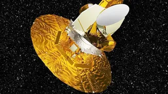
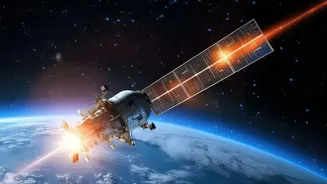
The source of this excitement is NISAR, which stands for NASA-ISRO Synthetic Aperture Radar. It is a powerful Earth-observation satellite born from a landmark collaboration between the US space agency, NASA, and the Indian Space Research Organisation
(ISRO). Launched from India's Satish Dhawan Space Centre on July 30, 2025, NISAR represents one of the most significant partnerships in the history of space exploration. For the first time, two different radar frequencies are operating on a single mission: NASA’s L-band and ISRO’s S-band. This dual-frequency capability makes NISAR uniquely powerful, providing a comprehensive and detailed look at Earth's surfaces. After a year of calibration, data from the mission was finally made public on July 20, 2026, offering researchers around the globe a revolutionary new tool.
Seeing the Unseen with Radar
Unlike typical satellites that capture images using visible light—much like a camera—NISAR uses Synthetic Aperture Radar (SAR). It works by sending microwave signals towards Earth and analysing the echoes that bounce back. This technology gives NISAR a superpower: it can see through clouds, darkness, and even smoke. This is especially crucial for a place like Antarctica, which is shrouded in clouds and experiences months of polar darkness, making it impossible for optical satellites to monitor consistently. NISAR's radar can penetrate snow and ice, revealing the hidden structure and movement beneath the surface. This allows scientists to observe the continent 24/7, in all weather conditions, capturing changes with incredible precision.
The 'Hummingbird' and Hidden Details
One of the first images released captured the world's imagination. It shows a vast Antarctic ice stream flowing around a rocky mountain peak, or 'nunatak'. The stresses on the ice have created deep cracks and crevasses, which form a shape strikingly similar to a hummingbird in flight. This image is more than just a beautiful coincidence; it's a stunning demonstration of NISAR's capability. The different colours in the radar image distinguish between smooth ice (magenta) and rough, fractured surfaces (green), revealing the glacier's dynamics in detail that would be completely invisible in a standard photo. As one NASA engineer noted, with NISAR, scientists are seeing what is hidden beneath the surface, providing fundamentally different properties of Antarctic ice than ever before.
A Crystal Ball for Sea-Level Rise
The data from Antarctica is so exciting because the continent's ice sheets are the single largest potential contributor to global sea-level rise. They hold enough frozen water to raise sea levels dramatically if they melt. However, predicting how quickly this will happen is one of the biggest challenges in climate science. NISAR is set to change that. By scanning nearly the entire planet every 12 days, it can measure changes in ice speed and stability with centimetre-level accuracy. This steady stream of reliable data will allow scientists to track glacier movements, understand ice sheet collapse, and drastically improve the models used to forecast future sea-level rise. It gives researchers a time-lapse view of exactly how and where the ice is melting.
Why This Matters for India
For India, NISAR is not just a point of pride for ISRO's technological prowess; it's a critical tool for national security and planning. With over 7,500 kilometres of coastline, India is highly vulnerable to the impacts of rising sea levels. Understanding how fast Antarctica's ice is melting is directly linked to protecting coastal cities, communities, and infrastructure. Beyond polar science, NISAR's data will be invaluable for India in other ways. ISRO has identified key applications like monitoring agricultural lands, tracking groundwater supplies, and providing early warnings for natural hazards like landslides and earthquakes, all of which are of particular relevance to the subcontinent. The mission empowers India with unprecedented data to manage its resources and protect its population from the effects of a changing climate.