


What Exactly Is This 'Cyclone'?
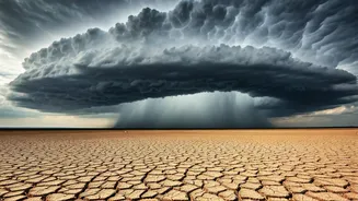
While the headline uses the word 'cyclone,' what’s currently influencing the weather over Central India is what the India Meteorological Department (IMD) calls a 'cyclonic circulation.' Think of it as a large, rotating system of clouds and thunderstorms,
but one that hasn't intensified enough to be classified and named as a formal tropical cyclone. This powerful system formed over the northeast Arabian Sea and adjoining coastal areas of Gujarat. Its primary function is to act like a massive engine, drawing moisture-laden winds from the sea and funnelling them directly over the Indian subcontinent. This is why regions far from the coast are experiencing such widespread and persistent rainfall.
Which Regions Are Most Affected?
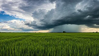
The impact of this system is being felt across a wide swathe of Central and Western India. States like Maharashtra, Madhya Pradesh, Gujarat, and parts of Chhattisgarh are at the centre of this wet spell. The IMD has issued various alerts, including orange and yellow warnings, for several districts within these states. For instance, cities like Mumbai and Pune have seen heavy downpours, leading to familiar issues of waterlogging and traffic disruption. In Madhya Pradesh, the system is bringing much-needed pre-monsoon showers, helping to lower scorching summer temperatures. The reach is significant, affecting daily life, agriculture, and travel for millions of people across this entire belt.
The Monsoon's Unlikely Helper
This cyclonic circulation is playing a crucial role in the larger story of the Southwest Monsoon. This year, the monsoon's arrival over the mainland in Kerala was slightly delayed. However, this system in the Arabian Sea has provided a significant push, helping the monsoon advance faster than expected into parts of Maharashtra and other regions. These systems create favourable conditions—strong westerly winds and a pressure gradient—that essentially 'pull' the monsoon current further inland. So, while it’s causing heavy rain now, it’s also a key player in ensuring the timely progression of the vital monsoon season, which is the lifeline for India's agriculture-dependent economy.
Relief from Heat, But Risks Remain
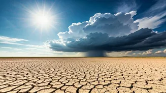
For a region reeling under intense summer heatwaves, the thick cloud cover and rain have brought welcome relief, with temperatures dropping by several degrees. However, this relief comes with its own set of challenges. Continuous, heavy rainfall increases the risk of urban flooding, as drainage systems struggle to cope with the sudden deluge. Landslides and mudslides become a concern in hilly areas, particularly in the Western Ghats. For farmers, while the rain is generally good news for kharif sowing, excessive water can also damage crops. Authorities have advised citizens in affected areas to stay cautious, avoid waterlogged streets, and check for weather updates before planning travel.
What Does the Forecast Say?
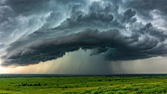
According to the IMD, this cyclonic circulation is expected to persist for the next few days, meaning the wet conditions are likely to continue across Central India. The system is predicted to move gradually east-northeastwards across the region, shifting the belt of heavy rain along with it. This means that while some areas might see a reduction in rainfall intensity, others could experience an increase. The primary advice is to stay informed through official channels like the IMD's website and app. As the system interacts with the advancing monsoon, weather patterns can remain dynamic, making it essential to keep an eye on the latest forecasts and advisories issued by local and national authorities.