

An Unblinking Eye on Earth
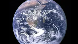
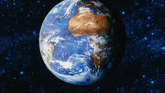
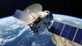
From space, Earth-observation satellites provide a wide, synoptic view that is impossible to get from the ground. When rivers swell and spill their banks, these satellites can capture the extent of the inundation over vast areas. This capability is vital
for India, a country highly vulnerable to flooding during the monsoon season. Agencies like the Indian Space Research Organisation (ISRO) use this technology to create near real-time maps of flooded areas, providing critical information to disaster management authorities to plan rescue and relief operations. The core principle is remote sensing—gathering information about the Earth's surface without physical contact. For floods, satellites use two primary types of sensors to 'see' the water: optical and radar.
Optical Satellites: A Camera in the Sky
Think of an optical satellite as a very powerful camera orbiting the planet. It captures images using sunlight, much like the camera on your phone. Water absorbs light differently than land or vegetation, particularly in the near-infrared part of the spectrum. By analysing these differences, scientists can identify and map water bodies. An algorithm called the Normalized Difference Water Index (NDWI) is often used to highlight water surfaces in satellite imagery, making flooded areas stand out. However, optical satellites have a significant weakness: they cannot see through clouds. This is a major problem during floods, which are almost always accompanied by heavy cloud cover from storms or cyclones.
SAR: The All-Weather Game-Changer
This is where Synthetic Aperture Radar (SAR) technology becomes a lifesaver. Unlike optical satellites that are passive (relying on the sun), SAR satellites are active sensors. They send out their own microwave pulses towards the Earth's surface and measure the signal that bounces back, known as backscatter. The key advantage is that these microwave signals can penetrate clouds, rain, and darkness, allowing SAR to provide clear images day or night, in any weather. This makes it the ideal tool for monitoring monsoon floods. Smooth surfaces like calm floodwater act like a mirror, reflecting the radar pulse away from the satellite. This makes flooded areas appear dark in SAR images, creating a sharp contrast with rougher land surfaces that scatter the signal back to the sensor and appear brighter.
From Raw Data to Actionable Maps
Receiving a satellite image is only the first step. This raw data must be processed and analysed to become useful. Specialists at agencies like ISRO's National Remote Sensing Centre (NRSC) compare pre-flood and during-flood imagery to detect changes and delineate the exact extent of the water. By combining information from different radar polarizations (the orientation of the radar waves), they can even detect flooding hidden beneath vegetation or within urban areas. These processed images are turned into detailed flood inundation maps. These maps are then quickly disseminated to national and state disaster management authorities, enabling them to see which villages, roads, and farmlands are affected, and where to direct emergency response teams. The turnaround time for creating these emergency maps has dramatically improved, from days to mere hours.
The Future: Sharper and Faster
The technology continues to evolve. India's collaboration with NASA on the NISAR (NASA-ISRO Synthetic Aperture Radar) mission promises to be a major leap forward. NISAR will be the first satellite to use two different radar frequencies (L-band and S-band), allowing it to measure changes on the Earth's surface with incredible precision. It will be able to map global flooding events with a high frequency, providing even more timely data for disaster response. The mission is specifically designed to aid in disaster management, agriculture monitoring, and understanding climate change impacts. As these technologies advance and are integrated with artificial intelligence and machine learning, their predictive power will grow, helping not just to respond to floods but to better forecast them.