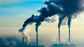









As Diwali approaches, the familiar joy of the festival is often accompanied by a blanket of smog. But what if you could know the air quality not just in your city, but on your very street? Technology now offers precisely that.
Beyond the City-Wide Average
For years, residents have
relied on a single Air Quality Index (AQI) number for their entire city. This figure, typically an average from a few government monitoring stations, often fails to capture the full story. Air pollution is hyper-local; the air in a leafy colony can be significantly cleaner than a traffic-clogged intersection just a few kilometres away. During Diwali, the difference is even more stark. Pockets of intense firecracker activity can create 'severe' air quality zones in one neighbourhood, while another remains merely 'poor'. Official data, which is often averaged over 24 hours, can also dilute the hazardous pollution spikes that occur late at night. This is where mobile apps are changing the game, providing the granular data needed to make informed decisions for your family's health.
How Apps Deliver Neighbourhood Data
The magic behind these hyper-local readings is a sophisticated blend of data sources. No single app relies on just one method. Instead, they create a comprehensive picture using a combination of inputs. First, they pull data from official government monitors, like those in the Central Pollution Control Board (CPCB) and SAFAR networks. These are the gold standard for accuracy but are sparsely located. To fill the gaps, many app developers have deployed their own networks of lower-cost sensors. Companies like IQAir, Aurassure, and Respirer Living Sciences have placed thousands of these sensors across Indian cities, often in collaboration with citizens and local bodies. Finally, this ground-level data is layered with satellite imagery, weather patterns, and even real-time traffic data. Artificial intelligence algorithms then process these millions of data points to generate a reliable AQI reading for your specific location, sometimes down to the street level.
Key Apps for Tracking Your Air
Several apps stand out for providing reliable, neighbourhood-specific data in India. IQAir AirVisual is a global leader with a dense network of its own sensors, supplementing government data to offer readings for over 500,000 locations. It also provides 7-day forecasts and historical data. AQI.in (from Ambee) specialises in hyper-local Indian coverage, aggregating data from multiple sources to give a granular view. SAFAR_Air, developed by the Ministry of Earth Sciences, is excellent for scientific forecasting in major metros like Delhi, Mumbai, and Pune. Sameer is the CPCB's official app, providing direct access to data from government monitoring stations, making it a trustworthy reference point. Google Maps has also integrated a real_time air quality layer, using an AI_powered system that fuses data from government sources, its own sensor partners, and satellites.
Making Data_Driven Decisions
Knowing your hyper_local AQI is the first step; acting on it is what matters. These apps provide crucial context by breaking down the levels of different pollutants like PM2.5 and PM10—tiny particles that can penetrate deep into the lungs and cause significant health issues. When the app shows a 'Severe' or 'Very Poor' reading for your area, you can take immediate action. This might mean keeping children and the elderly indoors, running an air purifier, wearing an N95 mask if you must go out, or avoiding strenuous outdoor exercise. Some apps even provide personalised health recommendations and forecasts that help you plan your day, such as scheduling a walk for a time when pollution is predicted to be lower. By turning complex data into actionable advice, these tools empower users to actively reduce their exposure to harmful pollutants during Diwali and beyond.