







The Double-Edged Sword of Tourism
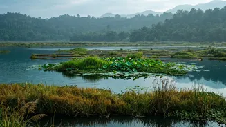
Kerala’s economy thrives on tourism, which brings in valuable revenue and creates jobs. Yet, the very elements that make it a top destination—the serene backwaters, lush Western Ghats, and pristine coastal areas—are ecologically sensitive. Unchecked development,
habitat fragmentation, and the sheer volume of visitors can place immense pressure on these natural assets. This has led to a critical challenge: how to foster a flourishing tourism industry without destroying the environmental capital it is built upon. The state has long been recognised for its commitment to sustainability, championing community-based initiatives and eco-conscious practices, but a more strategic tool was needed to guide future development.
Beyond the Map: A Digital Blueprint for Conservation
Ecosystem mapping is far more than just drawing boundaries. It is a sophisticated process that uses Geographic Information System (GIS) technology, satellite imagery, and on-the-ground surveys to create a detailed, layered understanding of the landscape. This digital blueprint identifies not just forests and rivers, but also biodiversity hotspots, vulnerable habitats, wildlife corridors, and areas prone to degradation. Recently, Kerala has undertaken a massive effort to create a State-level Ecosystem Red List Assessment, applying scientific criteria to evaluate the risk of collapse for various habitats, from riparian forests to coastal ecosystems across all 14 districts. This provides planners with a powerful, evidence-based tool to see exactly which areas are most in need of protection.
From Data-Driven Insights to Smarter Decisions
This detailed mapping directly informs sustainable tourism planning in several crucial ways. By clearly delineating Ecologically Sensitive Areas (ESAs), authorities can make informed decisions about land use. This means steering high-impact construction away from vulnerable zones, designing tourist trails that don't disturb wildlife, and determining the 'carrying capacity' of a destination to prevent overcrowding. For instance, studies in ecologically sensitive districts like Idukki have shown how development on steep slopes increases risks like landslides, highlighting the need for this kind of integrated planning. The maps allow planners to identify where tourism can be developed safely and where it must be restricted, ensuring a balance between economic growth and ecological preservation.
Empowering Communities, Protecting Livelihoods
One of the most significant aspects of Kerala's approach is the focus on community involvement. The state’s Responsible Tourism Mission has been a pioneer in making local residents active stakeholders rather than passive bystanders. Detailed ecosystem maps strengthen this model. By identifying natural and cultural assets at a local level, they empower panchayats and Biodiversity Management Committees to develop their own conservation and tourism plans. This fosters the growth of community-led eco-tourism—such as homestays, local guide services, and craft collectives—that provide sustainable livelihoods and give communities a direct incentive to protect their environment. It’s a model that turns villagers into the most effective guardians of their natural heritage.
A Sustainable Blueprint for the Future
Kerala's initiative to scientifically map its at-risk ecosystems is not just about mitigating harm; it's about building a resilient and truly sustainable tourism economy for the long term. It moves conservation from a reactive to a proactive stance. By integrating this spatial data into its State Action Plan on Climate Change, Kerala is preparing for future environmental challenges while ensuring its development is sustainable. This approach serves as a powerful blueprint for other states in India, demonstrating how technology and community participation can be combined to protect precious natural resources while fostering responsible economic growth. It ensures that 'God's Own Country' remains a treasure for generations to come.