







The Monsoon’s Treacherous Toll
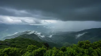
The Western Ghats, a UNESCO World Heritage Site, are a lifeline for peninsular India, influencing weather patterns and hosting incredible biodiversity. However, during the monsoon season, this vital mountain range turns perilous. Intense rainfall saturates
the steep slopes, leading to frequent and devastating landslides. These events are not just natural occurrences; their frequency and severity are often amplified by human activities like deforestation and unregulated construction. Entire hillsides can give way, burying homes, blocking critical roadways, and isolating communities. In recent years, states like Kerala and Maharashtra have witnessed catastrophic landslides causing significant loss of life and property, highlighting the region's acute vulnerability. The challenge has always been the unpredictability of these events, with disaster response teams often reacting after the fact.
The Limits of Traditional Warnings
For decades, managing monsoon hazards relied on a combination of historical data, weather forecasts, and manual observation. Authorities would issue broad warnings for entire districts based on rainfall predictions. While helpful, this approach lacks precision. A generic alert can’t pinpoint which specific slope is on the verge of collapse. Visual inspections are often impractical on such a vast and rugged terrain, especially during torrential downpours when visibility is poor and access is dangerous. This reactive stance means that evacuations and emergency responses are often initiated only after a disaster has struck, when the window to save lives has already narrowed considerably. The need for a more proactive, precise, and real-time system has become painfully evident.
Enter the Live GPS Beacon
This is where live GPS beacons and other sensor-based technologies come in. Unlike the GPS in your phone used for navigation, these are highly sensitive, survey-grade instruments designed to detect minute movements of the earth. Deployed in networks across landslide-prone areas, these beacons, along with sensors measuring soil moisture and rainfall, create a live monitoring grid. Each beacon continuously tracks its precise position, down to the millimeter. This data is transmitted in real-time to a central server. If a slope begins to deform or shift, even imperceptibly, the system registers the change in the beacons' coordinates long before any visible signs of a landslide appear. This provides a direct, data-driven insight into the stability of the ground itself.
From Tiny Movements to Timely Alerts
The true power of this technology lies in turning raw data into actionable warnings. Sophisticated algorithms and AI models analyze the incoming stream of data from the GPS beacons and other sensors. These systems learn to recognize patterns that are precursors to slope failure. When the rate of ground movement crosses a critical threshold, the system can automatically trigger an early warning. These alerts can be sent via SMS to residents and broadcast through local sirens, giving communities and disaster management authorities crucial lead time—sometimes hours—to act. This allows for targeted evacuations of the most at-risk areas, closure of specific roads, and mobilization of emergency services before the disaster unfolds. Pilot projects by institutions like Amrita University in Munnar and IIT Mandi in the Himalayas have already demonstrated the life-saving potential of such real-time warning systems.
A Proactive Future for Disaster Management
The use of live GPS beacons represents a fundamental shift in disaster management—from a reactive model based on generalized forecasts to a proactive strategy driven by real-time, hyper-local data. It allows authorities to focus resources precisely where they are needed most. This technology doesn't just warn of impending landslides; it helps build a comprehensive understanding of how different slopes behave under varying rainfall conditions, improving risk mapping for the future. While cost and large-scale deployment remain challenges, indigenous, low-cost versions of these systems are being developed in India, making them more scalable. By providing a window of opportunity to act before a hill collapses, these digital sentinels are not just useful tools; they are becoming an essential component in safeguarding the lives and livelihoods of millions who call the Western Ghats home.