






The Big Picture: Eyes on Earth
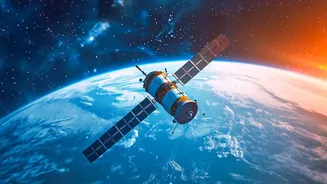
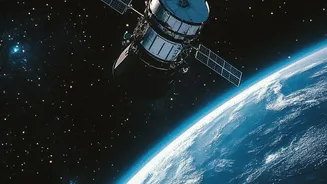
For any space-faring nation, looking back at Earth is as important as venturing out into the cosmos. Earth Observation (EO) satellites are the workhorses of modern space programs. They are our eyes in the sky, equipped with powerful sensors and cameras
that monitor the planet's land, oceans, and atmosphere. This capability is not just about taking impressive pictures; it's a critical national asset. EO data drives everything from weather forecasting and disaster management to urban planning and agricultural monitoring. For a country as geographically diverse and dynamic as India, having a robust, self-reliant EO program is essential for economic development, environmental stewardship, and national security.
ISRO's Strategic Vision
ISRO has a long and successful history with its Indian Remote Sensing (IRS) satellite system, which began in 1988 and has since become one of the largest civilian constellations in the world. In recent years, ISRO has consolidated its various programs under the Earth Observation Satellite (EOS) banner. The goal is to provide continuous and improved data for a wide range of applications. This includes satellites in different orbits to serve different purposes. While most EO satellites are in a Polar Sun-Synchronous Orbit (passing over the same part of the Earth at the same local time), a key strategic goal has been to place an imaging satellite in a Geostationary Orbit (GSO). A GSO satellite orbits at about 36,000 km and moves in sync with the Earth's rotation, allowing it to seemingly 'hover' over a specific region. This provides an unprecedented ability for continuous monitoring.
Enter EOS-05: The Constant Watcher
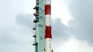
This is where EOS-05 comes in. Also known as GISAT-1A, EOS-05 is a state-of-the-art spacecraft designed to be India's first imaging satellite placed in a geosynchronous orbit. Its launch, scheduled for early September 2026 aboard a GSLV-F17 rocket, is one of ISRO's most anticipated missions. EOS-05 is the planned replacement for the nearly identical GISAT-1 (EOS-03), which was lost in a launch failure in August 2021. The successful deployment of EOS-05 would fulfill the long-held objective of having a persistent eye over the Indian subcontinent and the vast Indian Ocean region. Its high-resolution cameras will be able to provide near real-time imagery of large areas, with the capability to capture an image of a selected field every five minutes and the entire Indian landmass every 30 minutes.
From National Security to Disaster Relief
The applications for a satellite like EOS-05 are vast and vital. From a strategic perspective, it offers a significant advantage in monitoring border areas and maritime movements. For disaster management, its ability to provide continuous updates is a game-changer. Imagine tracking the path and intensity of a developing cyclone in real-time, or monitoring the spread of forest fires and the extent of flooding as it happens. This allows for more effective early warnings and rapid mobilisation of relief efforts. Beyond emergencies, the satellite will also support a range of civilian applications, including better monitoring of agriculture, forestry, and environmental changes. Its multispectral and hyperspectral imaging capabilities will provide rich data for mineralogy, oceanography, and resource management.
A Key Piece in a Larger Puzzle
EOS-05 is not an isolated mission; it is a crucial component of ISRO's broader Earth Observation push, which includes a diverse fleet of satellites. The RISAT series (like EOS-04) provides all-weather, day-and-night observation using synthetic aperture radar, which is invaluable during the monsoon season when clouds obscure optical views. The Oceansat series monitors ocean parameters, while the Resourcesat series focuses on land and water resources. Together, these satellites form a multi-layered system that provides a comprehensive and uninterrupted stream of data. The launch of EOS-05 is a critical step forward, filling a strategic gap and enhancing India's capacity for high-frequency monitoring from a geostationary perch.