





The Unstoppable Growth of Our Cities
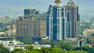
India's cities are expanding at a staggering pace, a trend vividly captured by satellite imagery. High-resolution data from agencies like ISRO and NASA shows the physical footprint of cities like Bengaluru, Hyderabad, and Pune growing by kilometres every
year. This isn't just about new buildings; it's a story of transformation. Comparing images over time, planners can see exactly where farmland has turned into housing colonies and how green belts are shrinking. In Bengaluru, for example, long-term studies have documented the alarming encroachment on its historic lake network. This data is crucial for urban local bodies to track unplanned growth, which often outpaces official records and strains essential services like water, roads, and drainage for millions.
An Unblinking Look at Our Forests
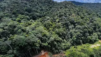
Beyond the concrete jungles, satellites are keeping a close watch on India's green cover. They provide a reliable method for monitoring deforestation and the effectiveness of afforestation drives on a massive scale. For instance, imagery has shown the extent of deforestation in areas like Assam's Sonitpur district, where vast forest lands were converted to agricultural use and settlements over three decades. This technology can differentiate between various causes of tree cover loss, such as logging, wildfires, or expansion for agriculture and infrastructure. The data also helps identify hotspots for man-made forest fires and land degradation, where productive land is slowly turning arid. Analysis from ISRO has shown that nearly 30% of India's land is undergoing some form of degradation.
The Critical Story of Water
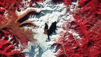
Perhaps the most critical story told by satellites is about water. In the Himalayas, decades of satellite photos, including declassified spy satellite images from the 1970s, have created a clear, four-decade record of glacier melt. Studies combining this historical data with modern satellite imagery reveal that the melting of Himalayan glaciers has doubled since the turn of the century. Hundreds of the largest glaciers across India, Nepal, and Bhutan are losing billions of tonnes of ice annually. ISRO's own analysis confirms that hundreds of glacial lakes have expanded significantly, some more than doubling in size since 1984, increasing the risk of outburst floods. At the same time, NASA's GRACE satellites, which measure tiny shifts in Earth's gravity, have shown a drastic depletion of groundwater in northwestern India. Between 2002 and 2008 alone, the region lost a volume of groundwater double the capacity of India's largest surface reservoir, almost entirely due to human consumption for agriculture.
Transforming Indian Agriculture
For the agricultural sector, which employs a vast portion of India's population, satellite data is becoming a revolutionary tool. With most farms being small, traditional census data often fails to capture the true picture. Satellites bridge this gap, monitoring crop health, soil moisture, and vegetation density across millions of smallholdings. This intelligence, often delivered to farmers via mobile apps, can detect crop stress from pests or lack of nutrients weeks before it's visible to the naked eye. This allows for precise interventions, improving yields and conserving resources. Furthermore, satellite data helps in creating accurate crop histories, making smallholder farmers more credible borrowers for banks and potentially transforming access to formal credit.