




The Challenge of Urban Monsoons
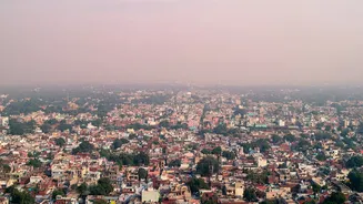
Predicting monsoon rainfall has always been a complex task, but it becomes exceptionally difficult in urban environments. Cities create what are known as 'urban heat islands', where concrete and asphalt absorb and radiate more heat than natural landscapes.
This can alter local atmospheric conditions, leading to the rapid formation of intense, localised thunderstorms that are notoriously hard to forecast using conventional ground-based methods alone. These short, severe spells of rain can overwhelm drainage systems in minutes, making accurate, real-time prediction not just a convenience, but a critical component of urban disaster management.
India’s Watchful Eyes in Geostationary Orbit
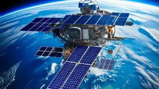
To meet this challenge, the Indian Space Research Organisation (ISRO) has developed and deployed a sophisticated network of meteorological satellites. The backbone of this system is the Indian National Satellite (INSAT) series. Satellites like INSAT-3D and INSAT-3DR are positioned in geostationary orbit, meaning they remain fixed over the Indian subcontinent. This allows for continuous, uninterrupted observation of weather patterns. Equipped with advanced imagers and sounders, these satellites capture detailed data on cloud formation, temperature, and atmospheric moisture every 15 minutes. This high frequency of observation is vital for what is known as 'nowcasting'—predicting weather conditions for the immediate few hours, which is essential for tracking fast-developing urban storms.
The Power of Seeing Through Clouds
While the INSAT series provides a constant stream of invaluable data, it has limitations. The optical and infrared sensors on these satellites cannot see through thick monsoon cloud cover. This is where India’s constellation approach provides a distinct advantage. ISRO also operates the Radar Imaging Satellite (RISAT) series, which uses Synthetic Aperture Radar (SAR). Unlike optical sensors, radar can penetrate clouds, dust, and darkness, making it an all-weather monitoring tool. By emitting microwave signals and analysing the backscatter, RISAT satellites can determine the texture of the surface below, allowing them to differentiate between dry land and inundated areas with remarkable precision. This is a game-changer for monitoring urban floods as they happen, even during a heavy downpour.
A Multi-Layered, Coordinated System
The term 'unmatched' stems not from a single satellite, but from the integration of these different types of data. India has created a synergistic system where geostationary satellites like INSAT-3D provide the big picture and track the formation of weather systems, while radar satellites like RISAT offer a detailed, penetrative view. Information from the Indo-French Megha-Tropiques satellite adds another layer, focusing specifically on the convective systems in tropical weather. This combination allows the India Meteorological Department (IMD) to generate highly specific quantitative precipitation estimates, track cloud movement, and issue precise warnings for districts and even smaller localities.
From Raw Data to Life-Saving Alerts
The vast amount of data gathered by this constellation is fed into sophisticated weather prediction models. Over the years, ISRO and the IMD have developed indigenous algorithms and platforms, such as the Hydro-Estimator Nowcaster, to process satellite data and generate forecasts for intense rainfall events up to three hours in advance, with regular updates. This flow of information is critical for on-ground disaster response teams, enabling them to make timely decisions about deploying resources, managing traffic, and alerting citizens in vulnerable low-lying areas. The improved accuracy, driven by satellite data assimilation, has enhanced short to medium-range forecasting by an estimated 20-30%.