








An Unprecedented Eye in the Sky
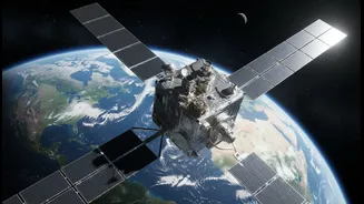
NISAR is the world's first satellite to use two different radar frequencies, a testament to the powerful space partnership between India and the United States. Developed jointly by the Indian Space Research Organisation (ISRO) and NASA, this Earth-observing
satellite was launched aboard an Indian GSLV rocket. Its mission is to scan nearly all of Earth’s land and ice surfaces twice every 12 days, providing a consistent and reliable stream of high-resolution data. Unlike optical satellites that are blinded by clouds or darkness, NISAR uses advanced radar that can see through any weather, day or night, making it a uniquely powerful tool for a monsoon-reliant country like India.
The Magic of Dual-Frequency Radar
At the heart of NISAR's capability is its dual-frequency Synthetic Aperture Radar (SAR). NASA provided the L-band radar, while ISRO developed the S-band radar. This combination is a game-changer. The longer wavelength L-band can penetrate dense forest canopies and soil to measure phenomena like biomass and ground deformation. The shorter S-band is more sensitive to smaller vegetation and surface details, making it ideal for monitoring crop health and soil moisture. Together, they create a comprehensive, multi-layered view of the Earth's surface, detecting changes as small as a centimetre. This unprecedented level of detail will fuel applications across various sectors in India.
A Revolution for Indian Agriculture
For India’s vast agricultural sector, NISAR’s data promises a new era of precision and planning. The satellite's ability to map soil moisture with a resolution of 100 meters is a significant leap forward. This will allow for more efficient irrigation, helping farmers manage water resources in a changing climate. By tracking crop growth, health, and acreage from planting to harvest, the mission will provide vital information for yield prediction and ensuring national food security. Authorities will be able to monitor the impact of droughts in near-real-time and deploy resources more effectively, transforming agricultural management from reactive to proactive.
Protecting India's Vulnerable Coastlines
With a coastline stretching over 7,500 kilometres, India is highly vulnerable to coastal erosion and sea-level rise. NISAR is set to become a critical guardian of these coastal zones. Its data can precisely monitor shoreline changes, identify erosion-prone areas, and assess the health of natural buffers like mangroves and sand dunes. In the event of a cyclone, the satellite can map the extent of storm surge flooding even through heavy cloud cover, aiding rescue and relief efforts. This information will also be invaluable for long-term coastal planning, protecting infrastructure and the millions of people who live in these fragile regions.
A Watchful Guardian Against Natural Hazards
NISAR's most profound impact may be in the field of disaster management. The satellite can detect tiny, centimetre-scale ground movements that can be precursors to earthquakes and landslides, offering a potential path toward early warnings. For a country with the seismically active Himalayas, this capability is crucial. The satellite's all-weather imaging will allow for rapid and accurate damage assessment after floods, earthquakes, or cyclones, guiding first responders to the worst-hit areas. It will also monitor the health and melting rates of Himalayan glaciers, which are a vital water source for hundreds of millions downstream.