




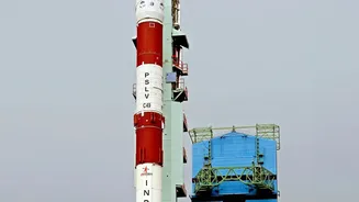
From Guesswork to Precision
For decades, forecasting the monsoon's sudden surges and localised extreme rainfall events was a significant challenge. Traditional forecasting methods provided a broad overview but often lacked the granular detail needed for effective, on-the-ground
disaster management. The need was for technology that could peer inside a developing storm system, understand its intensity, and predict its path with pinpoint accuracy. This is where the limitations of older systems became apparent, paving the way for a crucial technological leap forward in India's meteorological capabilities.
Enter the Doppler Radar Network
The game-changer has been the nationwide expansion and upgradation of the Doppler Weather Radar (DWR) network, a joint effort involving the India Meteorological Department (IMD) and technological expertise from the Indian Space Research Organisation (ISRO). These aren't just any radars; many are now dual-polarisation systems. Unlike older radars that sent out only horizontal radio waves, dual-pol radars send out both horizontal and vertical pulses. This seemingly small change provides a far more detailed, three-dimensional view of weather systems, marking a significant upgrade in India's forecasting arsenal. The network has expanded dramatically, aiming to cover the entire country by 2025.
Seeing Inside the Storm
So, how does this technology work? A DWR emits microwave signals that bounce off precipitation particles like raindrops or hail. By measuring the time it takes for the signal to return, the radar determines the location and intensity of rainfall. The 'Doppler effect'—the same principle that changes the pitch of a passing ambulance siren—allows the radar to detect the movement of these particles, revealing wind speed and direction within the storm. The dual-polarisation upgrade adds another layer of intelligence. By analysing the shape of the returning vertical and horizontal signals, meteorologists can distinguish between heavy rain, hail, and snow, and even estimate the size of raindrops. This level of detail is critical for predicting flash floods.
Turning Data into Lifesaving Warnings
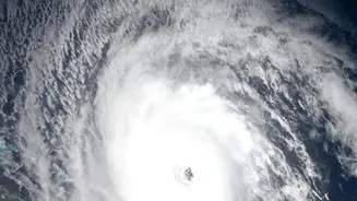
This flood of high-quality data is the backbone of modern weather prediction. Raw data from the DWR network, along with information from ISRO's weather satellites like the INSAT series, is fed into powerful supercomputers. These machines run complex numerical models to generate highly accurate, short-range forecasts and nowcasts—predictions for the next few hours. This allows the IMD to issue timely and specific warnings not just for a state or district, but for smaller, localised areas. This improved accuracy, which has seen a 20-40% jump for severe weather events, enables disaster management agencies to act decisively, evacuate vulnerable populations, and pre-position resources before a deluge hits.
The Difference on the Ground
The real-world impact is profound. What was once a generalised heavy rainfall alert can now be a specific flash flood warning for a particular set of neighbourhoods. This allows for more targeted and effective responses, saving lives and minimising economic damage. The expanded network, with radars in strategically important and previously uncovered regions like the Himalayas, helps monitor for cloudbursts and landslides with greater precision. While ISRO's primary role is in the design and development of the technology and its satellite components, its collaboration with the IMD, the end-user, ensures that space-age tech has a direct and tangible benefit for every citizen during the volatile monsoon season.