




What is the Latest IMD Forecast?
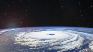
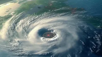
According to the India Meteorological Department (IMD), Cyclone Akvan has been moving slowly over the Bay of Bengal and is expected to strengthen significantly. As of the morning of November 18, the system had intensified into a Severe Cyclonic Storm.
Forecasters predict it will become a Very Severe Cyclonic Storm by the evening of November 19. The cyclone is projected to make landfall around noon on November 20, crossing the coast between Nellore and Visakhapatnam in Andhra Pradesh. At the time of landfall, maximum sustained wind speeds are expected to be in the range of 120-130 kmph, with gusts reaching up to 145 kmph.
Which Areas are on High Alert?
An Orange Message, signifying a high alert, has been issued for the coasts of Andhra Pradesh and adjoining south Odisha. Widespread rainfall is anticipated across coastal Andhra Pradesh, Yanam, and Telangana between November 19 and 21. The IMD has warned of heavy to very heavy rainfall in several locations, with the possibility of isolated extremely heavy spells on November 19 and 20. Authorities in affected states, including Odisha and West Bengal, have also been put on alert, with disaster response teams preparing for potential impacts like localised flooding, damage to crops, and disruptions to infrastructure. Fishermen have been strictly advised not to venture into the Bay of Bengal until November 20, and those already at sea have been urged to return to the coast immediately.
An Active Post-Monsoon Season
Cyclone Akvan follows two earlier storms, Arnab and Murasu, that also impacted India's east coast this season, making it a particularly active period for cyclonic activity. The post-monsoon cyclone season, which typically runs from October to December, is one of two peak periods for storm formation in the North Indian Ocean. Some forecasts generated earlier in the year suggested the possibility of three tropical cyclones forming during this post-monsoon period. The repeated storms have put a strain on coastal communities, particularly in Andhra Pradesh, which has faced back-to-back threats.
How Cyclones Get Their Names
The name 'Akvan' was contributed by Iran and is taken from a list of names proposed by 13 member countries of the World Meteorological Organization/ESCAP Panel on Tropical Cyclones. This organised system of naming began in the North Indian Ocean in 2004 to help in the quick identification of storms and to avoid confusion when multiple systems are active. The names are used sequentially from a pre-agreed list, and a storm is officially named by the IMD once it reaches the intensity of a Cyclonic Storm, which corresponds to wind speeds of over 63 km/hour. The name Akvan itself is rooted in Persian mythology.
How to Prepare and Stay Safe
With the cyclone approaching, it is crucial for residents in the identified coastal regions to take precautions. The IMD has warned of a phenomenal sea state, with wave heights potentially reaching 9 to 14 metres. Authorities have advised people in low-lying coastal areas to prepare for potential evacuation orders. It is important to secure your home, prepare an emergency kit with essentials like food, water, and first aid, and keep mobile phones charged. Stay indoors and away from windows and doors during the storm. Most importantly, follow the latest updates and advisories issued by the IMD and local disaster management authorities to ensure your safety. Do not rely on rumours and always verify information from official sources.