





The Junkyard Above Our Heads
Imagine a highway with no rules, filled with cars travelling ten times faster than a rifle bullet. That's the reality of Low Earth Orbit (LEO), the region of space up to 2,000 kilometres above us. For decades, every rocket launch and satellite deployment
has left something behind. This has created a vast field of 'space junk' — over 1.2 million untrackable fragments larger than a centimetre, including defunct satellites, spent rocket stages, and even flecks of paint. Travelling at speeds up to 28,000 km/h, even a tiny object carries enough kinetic energy to cripple or destroy a multi-crore satellite, potentially triggering a catastrophic chain reaction known as the Kessler Syndrome, which could render entire orbits unusable for generations.
Why India's Eyes in the Sky Are at Risk
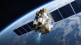
India's fleet of Earth-observation satellites are the unsung heroes of our modern infrastructure. They provide critical data for weather forecasting, agricultural planning, disaster management, and national security. A significant number of these crucial assets, about 20 of India's 22 active LEO satellites, operate right in this congested orbital band. This puts them at a heightened risk of collision. The problem is getting worse. ISRO has seen a steady increase in the number of Collision Avoidance Manoeuvres (CAMs) it must perform. In 2025, it executed 20 such manoeuvres, with another nine performed by August 2026, each one consuming precious fuel and shortening a satellite's operational lifespan.
Enter the AI-Powered Traffic Controller
Manually tracking thousands of potential threats for dozens of satellites is an impossible task. This is where artificial intelligence comes in. While the term 'AI thrusters' paints a simple picture, the reality is a sophisticated, layered system. India's primary defense is the ISRO System for Safe and Sustainable Space Operations Management (IS4OM), a dedicated facility in Bengaluru. This centre acts as the nerve centre, using AI-powered software to analyse a constant stream of data, predict potential collisions, and plot avoidance strategies. This system is supported by Project NETRA, an initiative to build a national network of radars and optical telescopes to track debris with greater accuracy. Together, these systems form an intelligent shield for India's assets in space.
How Satellites Learn to Play Dodgeball
The process is a high-stakes dance of data and physics. Ground-based systems, like the Multi-Object Tracking Radar in Sriharikota, feed data into ISRO's AI models. These algorithms analyse thousands of conjunction alerts—instances where a satellite and a piece of debris might have a close call. When the risk of collision crosses a critical threshold, the system automatically calculates the most efficient way to avoid it. An instruction is then sent to the satellite to perform a small, precisely-timed thruster burn. This 'nudge' is just enough to alter its trajectory and ensure it safely passes the debris. As AI models become more advanced, the goal is to make this process fully autonomous, allowing satellites to communicate and manoeuvre independently to ensure orbital safety.
A Debris-Free Future by 2030
Protecting current assets is only half the battle. India is also taking a leading role in ensuring it doesn't contribute further to the problem. ISRO has announced its intent for a 'Debris-Free Space Mission' (DFSM) initiative, with the ambitious goal of achieving zero-debris missions by 2030. This policy applies to all Indian space actors, both governmental and private. It mandates responsible practices, such as ensuring that rocket stages and defunct satellites are safely de-orbited or moved to a graveyard orbit at the end of their life. This forward-thinking approach, combining AI-driven protection with a commitment to sustainability, positions India not just as a space-faring nation, but as a responsible guardian of the orbital environment.