


Water Levels and Flow Rate
The single most important factor is the water level and its flow rate, measured in cubic feet per second (CFS). Meghalaya is one of the wettest places on Earth, and its rivers can swell dramatically in hours. Heavy rainfall, even miles upstream, can lead
to sudden, powerful surges and flash floods. Before your trip, ask your expedition provider for current and historical data for the specific river you'll be on. Many tour operators use gauges to monitor conditions. A river that is gentle at 200 CFS could be a dangerous torrent at 400 CFS. Your guide should be able to explain the safe range for your chosen route and skill level.
Upstream Weather and Flash Flood Risk
Your local weather forecast is only half the picture. In canyoning, what happens upstream is critically important. A sunny day at your launch point means little if a cloudburst is happening in the river's catchment area in the hills above. This is the primary cause of flash floods, where a wall of water can rush down a canyon with little warning. Experienced local guides are indispensable here, as they understand regional weather patterns and can interpret signs that outsiders might miss. Always ask your outfitter about their protocol for monitoring upstream weather and their emergency evacuation plans. Recent news from July 2026 highlights several flash flood events in Meghalaya caused by heavy rains, underscoring this danger.
Water Clarity and Debris
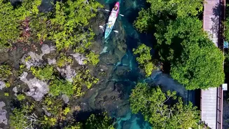
The pristine, clear waters of rivers like the Umngot are a major draw outside the monsoon. However, during the rains, this can change. Runoff from the surrounding land can make the water murky, reducing visibility. This makes it impossible to see underwater hazards such as submerged rocks, logs, or other debris that may have been washed into the channel. Fast-moving currents can carry large, dangerous debris. Poor clarity not only increases the risk of impact and entrapment but also makes rescue significantly harder. Before booking, inquire about the current water clarity and the types of hazards commonly found in that specific river during the monsoon.
River Grade and Accessibility
Rivers are graded by class (I-VI) based on their difficulty. A river's grade can change dramatically with the water level. A placid Class II section can become a raging Class IV during high water. Be honest about your skill level with your guide. An appropriate challenge for an expert can be a life-threatening situation for a novice. Furthermore, access to the put-in and take-out points can be compromised during the monsoon. Landslides and washed-out roads are common, potentially cutting off routes. Confirm with your operator that the access roads are open and stable just before your trip.
The Human Factor: Your Guide
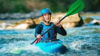
Ultimately, the most critical 'condition' to check is the expertise of your guide and the reputation of the outfitter. A qualified guide is more than just a paddler; they are a risk manager, a weather analyst, and a first responder. They should have intimate knowledge of the river, its moods, and its secret hazards. Ask about their certifications, their experience with monsoon expeditions on that specific river, and their safety protocols. Do they provide all necessary safety gear, including properly fitted personal flotation devices (PFDs) and helmets? Reputable companies will welcome these questions and answer them transparently. Never venture into a monsoon-fed canyon without a professional who knows the terrain intimately.