





The Challenge of Seeing a Flood
Floods are one of India’s most frequent and costly natural disasters, affecting millions of people and causing billions in damages annually. A critical challenge for disaster management teams has always been getting a clear picture of the situation on the ground.
Floods are, by nature, accompanied by heavy clouds and rain, which block the view of traditional optical satellites. By the time the skies clear, it is often too late for an effective and timely response. This has left responders working with incomplete information, struggling to identify the worst-hit areas, map the extent of waterlogging, and plan rescue operations efficiently.
NISAR: A New Vision in the Sky
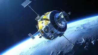
Enter NISAR, the NASA-ISRO Synthetic Aperture Radar mission. This state-of-the-art satellite, a product of collaboration between the two space agencies, isn't just another camera in space. Launched in 2025, NISAR is equipped with advanced radar instruments that can peer through clouds, darkness, and even dense forest canopies. It uses two different radar frequencies, L-band and S-band, to create incredibly detailed maps of Earth's surface. By scanning nearly the entire planet every 12 days, NISAR provides a consistent and reliable stream of data, regardless of weather or time of day, a true game-changer for disaster monitoring.
How Radar Makes Monitoring 'Smarter'
So, what makes Synthetic Aperture Radar (SAR) technology so special for flood mapping? Unlike optical cameras that need light, SAR sends out its own microwave signals and reads the echoes that bounce back. Calm water surfaces reflect the signal away, appearing as dark, smooth patches in the resulting images. This creates a stark, high-contrast map that clearly delineates flooded areas from dry land. NISAR’s dual-frequency system is particularly powerful. Its L-band radar can penetrate through vegetation, allowing it to detect waterlogging in agricultural fields and forested areas like the Sundarbans, something that was previously very difficult to monitor from space. This ability to see water under canopies provides a far more accurate picture of the flood's true extent.
From Data to Actionable Intelligence
The real power of NISAR lies in its ability to turn this raw data into actionable intelligence, and quickly. Data products from the mission can be made available to disaster management agencies within hours of a satellite pass, not days. This allows for a rapid assessment of the situation, helping to direct relief efforts to where they are needed most. For instance, recent S-band radar imagery from July 2026 has already demonstrated its capability in characterising the complex floodplains of the Brahmaputra River basin. Furthermore, by comparing images taken before and after a flood, authorities can precisely measure the affected area and even detect changes in water level as small as a centimetre, effectively turning the satellite into a network of 'virtual stream gauges'.
Building Resilience for the Future
Beyond immediate disaster response, NISAR’s consistent, long-term data will be invaluable for building future resilience. As climate change makes rainfall patterns more erratic and extreme weather events more common, understanding how landscapes are changing is crucial. By tracking subtle shifts in the ground, water levels, and land use over months and years, the mission will help scientists and urban planners identify high-risk zones. This information can inform better infrastructure planning, from building more resilient bridges and embankments to developing more effective land-use policies. It moves the needle from purely reactive disaster response to proactive risk management, which is essential for protecting communities across India.