







A Sharper Eye in the Sky
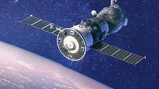
ISRO is enhancing its weather surveillance capabilities by integrating advanced, high-resolution radar sensors into its earth observation programmes. A key part of this upgrade is the NASA-ISRO Synthetic Aperture Radar (NISAR) satellite. This state-of-the-art
system uses radar to see through dense clouds, day and night, which is a major limitation for traditional optical satellites. Synthetic Aperture Radar, or SAR, works by sending microwave pulses to the Earth's surface and analysing the signals that bounce back. This allows it to create incredibly detailed images of the land and sea, revealing changes that are invisible to the naked eye. This all-weather, 24/7 monitoring capability is a game-changer for tracking the fast-developing and often unpredictable storms of the Indian monsoon.
Beyond Traditional Weather Watching
For decades, weather forecasting has relied on a combination of ground-based stations, weather balloons, and optical satellites like the INSAT series. While these have been the backbone of India's meteorological services, they have limitations. Optical satellites can't see through the thick cloud cover typical of monsoon depressions and cyclones. Ground radars can only cover a limited area, typically up to 500 kilometres, leaving vast stretches of the ocean unmonitored. High-resolution radar sensors, particularly space-based ones like NISAR, overcome these challenges. They can scan almost the entire planet every 12 days, providing consistent and comprehensive data on storm formation, intensity, and movement. The level of detail is so fine it can detect changes on the Earth's surface as small as a centimetre, offering a new dimension to weather and environmental monitoring.
How Better Data Saves Lives
The real-world impact of this technological leap forward is immense, especially for India's densely populated coastline. More precise data on cloud formation, wind speed, and moisture content feeds directly into more accurate weather models. This allows the India Meteorological Department (IMD) to issue earlier and more reliable warnings for cyclones, heavy rainfall, and potential flooding. Early warnings provide crucial lead time for disaster management agencies to evacuate vulnerable populations, secure infrastructure, and prepare response teams. The integration of radar data can pinpoint which coastal areas are most at risk from storm surges and map the extent of flooding in near-real-time, even through heavy rain. This capability directly translates into enhanced disaster preparedness, helping to save lives and protect property along India's vast and vulnerable coastline.
A Pillar of National Security
This advancement is part of ISRO's long-standing Disaster Management Support Programme, which leverages space technology for national security and public welfare. From providing near-real-time mapping of flood-affected areas to developing early warning systems for landslides, ISRO's satellites are a critical national asset. The new radar capabilities will also enhance monitoring of soil moisture, which is vital for agriculture, drought prediction, and water resource management. By tracking changes in soil wetness with high resolution, the system can support millions of farmers with crucial information for irrigation and crop planning. This holistic approach to earth observation underscores ISRO's commitment to using cutting-edge science for the direct benefit of the Indian people, from farmers in the field to fishermen at sea.