



Eyes in the Sky: What Satellites See
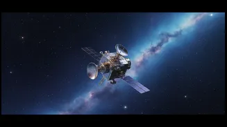
To understand and predict hazards like wildfires and volcanoes, scientists first need to see them clearly. Satellites are our eyes in the sky, equipped with powerful sensors that capture information invisible to the naked eye. For wildfires, instruments
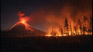
like the Visible Infrared Imaging Radiometer Suite (VIIRS) can detect thermal anomalies, or hotspots, that signify the birth of a fire, sometimes before it's even reported on the ground. These satellites measure the fire's heat output, known as Fire Radiative Power (FRP), which tells scientists how intense the fire is. For volcanoes, satellites can detect a wide range of warning signs. They can measure subtle ground deformation—the swelling or sinking of the volcano's surface—which might indicate magma moving beneath. They also track the release of gases like sulfur dioxide and monitor faint increases in ground temperature, both of which can be precursors to an eruption.
The Predictive Power of Models
Observing a disaster is one thing; predicting its next move is another. This is where scientific models come in. A model is essentially a complex computer simulation that uses the laws of physics and chemistry to forecast how a system will behave. Think of it like a weather forecast model, which predicts temperature and rainfall by simulating the atmosphere. Wildfire models, for instance, take into account factors like wind speed, terrain, and the type of vegetation (fuel) to predict how quickly and in which direction a fire will spread. Similarly, volcano models use data on seismic activity, gas emissions, and ground changes to estimate the likelihood and potential style of an eruption. These models are the key to turning raw data into actionable intelligence that can help authorities make critical decisions.
Calibration: Tuning the Model to Reality
A model is only as good as the data it's built on, and this is where calibration becomes essential. Calibration is the iterative process of adjusting a model's parameters to make its predictions more closely match real-world observations. In essence, it's about fine-tuning the simulation to reflect reality. Satellite data is the perfect input for this process. If a wildfire model predicts a fire will spread south, but satellite images show it moving southeast, scientists can use that information to calibrate the model. They might adjust how the model accounts for wind or the dryness of the fuel until its output matches what the satellites are seeing. This constant feedback loop, comparing model predictions to satellite observations and then tweaking the model, is what makes forecasts progressively more accurate over time.
The Indian Context: NISAR and Beyond
This technology is particularly relevant for India, which faces significant threats from forest fires, especially in the Himalayas, and has an active volcano on Barren Island. The NASA-ISRO Synthetic Aperture Radar (NISAR) mission, a landmark collaboration between the two space agencies, is set to revolutionize disaster monitoring. Launched in 2025, NISAR uses advanced radar to measure changes in Earth's surface with unprecedented precision—down to a centimeter. This capability will be invaluable for monitoring ground deformation at volcanoes like Barren Island, providing early warnings of unrest. For wildfires, ISRO's own satellites already contribute to disaster management systems by identifying fire hotspots. The data from NISAR will further enhance the ability to monitor forest biomass and soil moisture, which are critical inputs for calibrating fire risk and spread models. All NISAR data is openly available, allowing researchers across the country to improve our national disaster preparedness.
The Future is AI-Powered
The next leap forward involves integrating Artificial Intelligence (AI) and machine learning. The sheer volume of data from modern satellites is too vast for humans to analyze alone. AI algorithms can process satellite imagery thousands of times faster than traditional methods, identifying patterns that might precede a disaster. For instance, AI can be trained on historical satellite data to recognize the conditions that typically lead to a wildfire, creating dynamic risk maps. Google and its partners have even launched the FireSat constellation, which uses AI to scan high-resolution infrared images to detect new fires as small as 5x5 meters. By combining the constant stream of satellite data with the analytical power of AI, models can be calibrated in near real-time, offering faster and more precise warnings that help save lives and property.