





What Exactly Is El Niño?
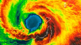
El Niño, which means 'The Little Boy' in Spanish, is a naturally occurring climate pattern. It begins thousands of kilometres away in the central and eastern equatorial Pacific Ocean with the unusual warming of sea surface temperatures. Under normal conditions,
strong trade winds blow from east to west, piling up warm water in the western Pacific. During an El Niño event, these trade winds weaken. This allows the massive pool of warm water to slosh back eastward, toward the coast of South America. This shift in ocean heat is so significant that it changes atmospheric circulation patterns across the globe, influencing weather far and wide, including the Indian monsoon.
The Monsoon Connection: A Strong Link, Not an Ironclad Rule
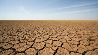
The primary way El Niño affects India is by disrupting the atmospheric circulation that drives the monsoon. This disruption can weaken the monsoon winds that carry moisture from the ocean to the subcontinent, leading to reduced rainfall. Historically, the correlation is strong; data shows that at least half of all El Niño years have resulted in monsoon droughts in India. The India Meteorological Department (IMD) noted that the moderate El Niño conditions that developed in June 2026 were a major driver behind the country's cumulative rainfall deficit. However, an El Niño year does not automatically guarantee a drought. The relationship is complex and has varied over time and across different regions of India.
The Wild Card: The Indian Ocean Dipole
While El Niño is the big player in the Pacific, the Indian Ocean has its own climate phenomenon called the Indian Ocean Dipole (IOD). The IOD is defined by the difference in sea surface temperatures between the western and eastern parts of the Indian Ocean. A 'positive' IOD, with warmer waters near the Horn of Africa and cooler waters near Indonesia, can be a saviour for the Indian monsoon. This setup helps bring more moisture towards the Indian subcontinent, potentially counteracting the drying effect of an El Niño. A positive IOD can therefore mitigate the adverse impacts of El Niño, which is why meteorologists watch both phenomena closely. The two patterns can co-occur, and their interaction is critical for the monsoon's outcome.
More Than Just Less Rain
Recent science has added a paradoxical twist to the El Niño story. While it often suppresses the total seasonal rainfall, studies have found that El Niño years can also increase the frequency of extreme, intense rainfall events in certain parts of India. Research shows that while the country as a whole may be drier, some regions, particularly in central India, might experience fewer rainy days but more powerful, concentrated downpours when it does rain. This creates a dual challenge: managing both drought-like conditions and the risk of sudden floods. This uneven distribution has significant consequences, affecting crop cycles, water reservoir levels, and the economy.
The Forecast for 2026
For 2026, the IMD has been closely monitoring a moderate El Niño that developed over the Pacific. This led to a forecast of below-normal rainfall for August and for the second half of the monsoon season (August-September combined). As of early August 2026, the cumulative seasonal rainfall was already 12% below the long-period average, a deficit attributed directly to the prevailing El Niño conditions. While some hope rested on a positive IOD developing late in the season to offset some of El Niño's impact, the overall projection remains subdued. This highlights the strong influence El Niño is exerting this year, even with other factors at play.