







The Evolution of Weather Alerts
For years, weather warnings were broad, often covering entire states or large meteorological sub-divisions. A traveller might know that heavy rain is predicted for a state but have little insight into which specific areas are most at risk. The IMD has
now moved towards a more granular system, providing district-level warnings and even impact-based forecasts. This new approach doesn't just predict the weather; it aims to outline the potential impact on infrastructure, transport, and daily life. This means instead of a generic "heavy rain" alert, you might see a warning that specifies the risk of waterlogging on major roads or potential disruptions to power in a particular district, making the information far more actionable for the public.
Why Route-Specific Checks Are Crucial
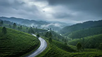
A journey from one city to another can cross multiple districts, each with its own microclimate and vulnerabilities. The weather at your starting point and destination could be perfectly calm, while a district halfway through your route might be under an orange or red alert for extreme rainfall and landslides. This is particularly true for journeys through hilly or coastal regions, which are more susceptible to sudden and intense weather events. The IMD's new Highway Forecast tool is a direct response to this need, providing weather predictions along the entire length of a driving route. This allows drivers to anticipate challenges, see which segments of their trip are affected, and make informed decisions, like altering their route or departure time to avoid dangerous conditions.
How to Access and Understand IMD Warnings
The primary tools for accessing these modern forecasts are the IMD's official 'Mausam' website and mobile app, available for both Android and iOS. These platforms provide district-wise warnings, nowcasts (short-term, three-hourly predictions), and access to radar imagery. Understanding the colour-coded alerts is simple but vital. 'Green' means all is well. 'Yellow' advises you to be aware, as conditions could worsen. 'Orange' means be prepared for potentially disruptive weather. 'Red' is the highest alert, signalling that you must take action to protect yourself, as severe, life-threatening conditions are expected.
A Modern Monsoon Travel Checklist
Relying on these new tools requires a shift in how we plan our travels. Before any monsoon journey, your first step should be to check the IMD's district-level and highway forecasts for your entire planned route, not just the destination. Pay close attention to any yellow, orange, or red alerts for the days you intend to travel. Always have a flexible itinerary; be prepared for delays or cancellations and consider having a backup plan. Packing appropriately is also key. Include waterproof bags for electronics and important documents, quick-drying synthetic clothing, and sturdy, waterproof footwear with good grip. A basic first-aid kit and a power bank are also non-negotiable essentials.
Beyond the Forecast: Staying Vigilant on the Road
Technology is a powerful enabler, but it's not a substitute for common sense. While en route, stay updated by listening to local news and following updates from traffic police and district authorities. Weather conditions, especially during the monsoon, can change rapidly. Be aware of your surroundings. If you encounter rising water levels, minor landslides, or debris on the road, it's often safest to turn back or find a secure place to wait for conditions to improve. Avoid driving at night in hilly or poorly lit areas, as potholes and other hazards are harder to spot. Finally, be cautious about what you eat and drink, as the risk of waterborne diseases increases during the rainy season.