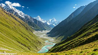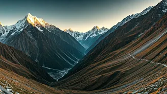


The Gateway: Chandra Valley
Your journey into Lahaul’s rugged heart begins in the Chandra Valley. Following the serpentine path of the Chandra River, this valley is a masterclass in contrasts. On one side, you have scree slopes and barren mountains painted in shades of brown, purple,
and grey. On the other, sparse patches of green cling to life near the riverbank. This is the first taste of the cold desert’s stark beauty. Keylong, the district headquarters, is nestled here, offering a base to acclimatise and plan further exploration. The drive from the North Portal of the Atal Tunnel through Khoksar and Sissu provides jaw-dropping views of glaciers and waterfalls cascading down near-vertical cliffs. It is a landscape that demands respect, reminding you of nature’s immense power.
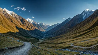
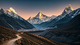
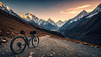
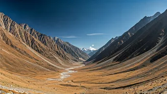
The River's Stark Kingdom: Bhaga Valley
Moving north from Keylong, you enter the Bhaga Valley, which feels even more remote and elemental. The topography becomes harsher, the mountains more imposing. The Bhaga River carves its path through this stark terrain, creating dramatic gorges and wide, stony riverbeds. This valley is home to Jispa, a serene hamlet that has become a popular stop for travellers heading towards Leh. The landscape here is defined by its vastness and silence. You can spend hours just watching the play of light and shadow on the mountainsides. The sparse vegetation and clusters of traditional Lahauli homes with their flat roofs and prayer flags fluttering in the wind add to the mystical atmosphere of this incredible region.
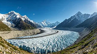
The High-Altitude Jewels: Suraj and Deepak Tal
Nestled within these rugged valleys are jewels of emerald and sapphire: the high-altitude lakes. Deepak Tal, a small but stunningly blue lake, is easily accessible from the Manali-Leh highway. It’s a perfect spot for a brief halt, its calm waters reflecting the surrounding snow-capped peaks. Further up, just before the Baralacha La pass, lies Suraj Tal, the 'Lake of the Sun God'. At an altitude of nearly 4,900 metres, this is one of India's highest lakes. Fed by glaciers, its water is a breathtaking shade of emerald green, often frozen until late in the summer. The air is thin, the wind is sharp, and the landscape is utterly barren, making the lake's vibrant colour feel like a miracle.
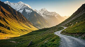
The Crossroads of Passes: Baralacha La
Baralacha La isn't just a mountain pass; it's a high-altitude crossroads where routes from Zanskar, Ladakh, Spiti, and Lahaul converge. Standing at over 4,890 metres, this pass offers a 360-degree panorama of desolate, snow-dusted mountains. The topography is a true high-altitude desert, a vast, windswept plateau where the sky feels incredibly close. The pass is the source of three rivers—Chandra, Bhaga, and Yunam—making it a geographical marvel. Navigating Baralacha La is an adventure in itself, with its sharp turns and unpredictable weather. It is a place that makes you feel small, a testament to the raw, unforgiving beauty of the high Himalayas.
A Touch of Green: The Pattan Valley
For a change from the stark, arid landscapes, a detour into the Pattan Valley is a must. Situated along the Chandra-Bhaga (Chenab) river after its confluence at Tandi, this valley is surprisingly fertile. Known as the 'Orchard and Granary of Lahaul', its terraced fields of potatoes, peas, and barley create a vibrant green patchwork against the backdrop of brown mountains. The villages here, like Udaipur (not to be confused with the city in Rajasthan), are more prosperous and bustling. The topography is less severe, with gentler slopes and a wider valley floor, offering a different but equally captivating side of Lahaul’s diverse geography. It shows the resilience of life and agriculture in this challenging high-altitude environment.