




The All-Seeing Eye in the Sky
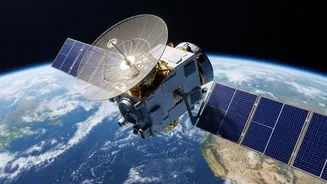
At the heart of this technological revolution are Earth Observation (EO) satellites. These instruments orbit our planet, equipped with sophisticated sensors that gather information far beyond what the human eye can see. Optical sensors capture detailed
images of the ground, allowing experts to spot everything from building damage to blocked roads. Meanwhile, Synthetic Aperture Radar (SAR) can penetrate clouds and rain, detecting ground movement and the extent of flooding, even during a storm. Thermal sensors identify heat patterns, which is crucial for tracking wildfires. Together, these technologies provide a continuous, reliable picture of conditions on the ground, offering insights that are impossible to obtain when severe weather or terrain makes an area inaccessible.
Before Disaster Strikes: Prediction and Preparedness
One of the most significant advantages of space technology is its role in disaster preparedness. By analyzing long-term satellite data, scientists can create detailed hazard maps that identify areas prone to floods, landslides, and seismic activity. This information is vital for urban planners and policymakers to make informed decisions about where to build and what preventative measures to implement. Meteorological satellites constantly monitor atmospheric conditions, helping to forecast tropical cyclones and other extreme weather events with greater accuracy. This advanced warning gives communities precious time to evacuate and allows authorities to allocate resources more effectively, ultimately saving lives.
During the Crisis: A Real-Time Lifeline
When a disaster hits, ground-based communication and infrastructure are often the first things to fail. This is where space technology becomes a critical lifeline. Satellites provide uninterrupted observation, offering real-time data on the evolving situation. Emergency responders can use this information to quickly see which communities are at risk, where roads have been destroyed, and which areas are most heavily damaged. Global Navigation Satellite Systems (GNSS), like GPS, are essential for guiding rescue teams through altered landscapes and helping coordinate helicopter drops in hard-to-reach zones. Furthermore, satellite communication networks ensure that response teams can stay connected even when local networks are down, facilitating a more coordinated and efficient relief effort.
After the Storm: Assessing Damage and Aiding Recovery
The role of space technology doesn't end when the immediate crisis is over. In the aftermath of a disaster, high-resolution satellite imagery is invaluable for conducting rapid and accurate damage assessments. This data helps governments and insurance agencies understand the scale of the destruction, enabling them to deploy relief funds and resources more strategically. It also informs the massive task of reconstruction, guiding engineers in rebuilding roads, bridges, and other critical infrastructure. By analyzing how the disaster unfolded, scientists can also refine their hazard models, helping communities build back stronger and become more resilient to future events.
India's Space Shield: The Role of ISRO
India, a country prone to a wide range of natural disasters, has heavily invested in using space technology for risk management. The Indian Space Research Organisation (ISRO) operates a fleet of Earth observation satellites that provide crucial, near real-time information to national and state disaster management agencies. Through its Disaster Management Support Programme, ISRO actively monitors floods, cyclones, landslides, and forest fires across the country. Geoportals like Bhuvan and the National Database for Emergency Management (NDEM) provide interactive maps and data to officials, aiding in everything from early warnings to post-disaster recovery planning. ISRO also plays a significant role in international collaborations, sharing data and expertise through frameworks like the International Charter 'Space & Major Disasters' and Sentinel Asia.