





What Makes This Satellite Different?
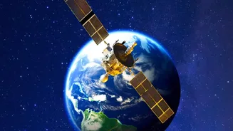
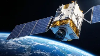
Most Earth-observation satellites circle the planet in a low Earth orbit (LEO), meaning they pass over a specific location for only a few minutes each day. GISAT-1A, also known as EOS-05, is different. It will be placed in a geostationary orbit (GEO)
approximately 36,000 kilometres above the equator. At this altitude, its orbital speed matches the Earth's rotation, causing it to appear stationary over the Indian subcontinent. This fixed position is a game-changer, transforming satellite monitoring from brief, periodic snapshots into a continuous, unbroken video feed of the region. It allows ISRO to watch events unfold in near real-time, a capability India has been working to secure for years.
A Second Chance After Failure
The upcoming launch on September 4, 2026, carries the weight of past disappointment. This mission is a second attempt after the original satellite, GISAT-1 (also called EOS-03), was lost during its launch in August 2021. The GSLV-F10 rocket carrying it suffered a technical anomaly in its cryogenic upper stage, which failed to ignite, preventing the satellite from reaching orbit. The failure was a significant setback, leaving a critical gap in the country's strategic observation capabilities. Now, five years later, ISRO is ready to launch its successor, GISAT-1A, aboard the GSLV-F17 rocket, in a mission that is as much about redemption as it is about technological advancement.
An Unblinking Eye for National Security
While GISAT-1A has broad civilian applications, its strategic importance cannot be overstated. A geostationary satellite provides an unprecedented advantage for monitoring borders and areas of interest. The ability to image a specific location every five minutes and the entire country twice an hour offers what is known as high temporal resolution. This frequent revisit capability allows security forces to monitor troop movements, infrastructure development, and other changes across sensitive borders with a persistence that lower-orbit satellites cannot match. While not a replacement for ground intelligence, it serves as a powerful force multiplier, providing a constant stream of high-level situational awareness to aid in planning and response.
A Lifesaver in Natural Disasters
Beyond security, GISAT-1A is poised to become a vital tool for disaster management. India's geography makes it vulnerable to a range of natural calamities, from cyclones on its long coastlines to floods and forest fires inland. Standard satellites might capture an image of a cyclone once or twice a day. In contrast, GISAT-1A can track its development continuously, providing invaluable data on its path, intensity, and potential impact. This near real-time monitoring enables authorities to issue more accurate warnings, plan evacuations more effectively, and dispatch rescue teams with a clearer understanding of the on-ground situation, potentially saving thousands of lives and minimizing damage.
Powering India's Growth and Climate Action
The satellite's advanced imaging capabilities extend to numerous other sectors vital for India's economy and environment. Its multi-spectral and hyperspectral cameras can analyze the health of crops, monitor water levels in reservoirs, and track the green cover of forests. This data is crucial for precision agriculture, helping farmers optimize water and fertilizer use. It can also monitor the melting of Himalayan glaciers, assess changes in land use in and around expanding cities, and track pollution in water bodies. By providing a constant stream of high-quality data on the nation's natural resources, GISAT-1A will support both economic planning and long-term climate change mitigation efforts.