


Planning Your Route and Ride
The journey from Bangalore to Agumbe covers approximately 350-380 kilometres and typically takes around seven to eight hours, depending on the chosen route and breaks. The most commonly recommended route runs through Hassan, Belur, and Thirthahalli. This
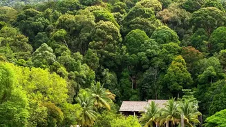
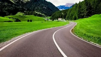
path offers a good mix of smooth highways and scenic country roads leading into the dense forests of the Malnad region. While the roads are generally in good condition up to Thirthahalli, the final stretch into Agumbe involves navigating the famous ghat section with its sharp hairpin bends. Given the challenging nature of the ghats, especially during the monsoon, it's advisable to plan your drive to ensure you cross this section during daylight hours. Heavy vehicle movement may be restricted during peak monsoon to prevent landslides, which can make the drive smoother for cars but also signals the need for caution.
Monsoon Driving: A Guide to the Ghats
Driving in the Western Ghats during the monsoon is an experience that demands respect and preparation. The roads become slippery, and visibility can drop to near-zero in seconds due to heavy rain and thick fog. First, ensure your vehicle is monsoon-ready: check that your tyres have adequate tread, your brakes are in top condition, and your wiper blades are new or in excellent shape. On the road, the golden rule is to slow down. Braking distances increase significantly on wet surfaces, so maintain at least double the usual distance from the vehicle ahead. Use your low-beam headlights even during the day to improve your visibility to others. When navigating blind curves and hairpin bends, honk to alert oncoming traffic and stick to your lane. It is customary to give way to vehicles driving uphill, as they require more momentum. Most importantly, avoid driving through the ghats at night, when pouring rain and fog can create pitch-black, treacherous conditions.
Photo Location: The Agumbe Sunset View Point
While famous for its sunsets, the Agumbe Sunset View Point offers a different kind of magic during the monsoon. Instead of a fiery sun dipping below the horizon, you're treated to a dramatic spectacle of mist and clouds rolling over the sprawling green hills of the Western Ghats. The viewpoint provides a panoramic vista that, on a clear monsoon day, can stretch all the way to the Arabian Sea. It’s the perfect spot to capture the moody, atmospheric beauty of the region. The interplay of light, fog, and endless layers of hills creates a breathtaking frame that defines the Malnad monsoon experience. Be prepared for strong winds and sudden showers, and keep your camera protected.
Photo Location: The Waterfalls of Agumbe
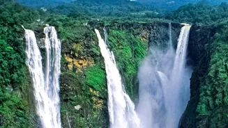
Agumbe and its surroundings are dotted with waterfalls that are at their most powerful and majestic during the monsoon. Onake Abbi Falls, one of the tallest in the region, requires a short trek through the dense rainforest to reach. Its name, meaning 'pole-like falls,' aptly describes the single, powerful cascade. Jogi Gundi Falls is another popular spot, unique because the water originates from a cave and flows into a large, natural pool where visitors often take a dip. These locations are not just about the falls themselves but also the journey through the vibrant, rain-soaked jungle, offering countless opportunities to photograph the rich biodiversity, from tiny frogs to lush, moss-covered trees.
Photo Location: Kundadri Hill and Beyond
For a stunning 360-degree view of the Agumbe rainforest, a drive up Kundadri Hill is a must. At the top, you'll find an ancient Jain temple surrounded by rolling green landscapes that are often shrouded in a carpet of fog during the monsoon. The winding road leading to the peak is a photographic subject in itself. Another nearby spot worth visiting is the Nagara Fort, which transforms into a lush green carpet during the rains and offers a historical element amidst the natural beauty. These locations provide a broader perspective of the region's topography and are ideal for capturing sweeping landscape shots that showcase the scale of the Western Ghats.