






Eyes in the Sky: What is Satellite Crop Data?
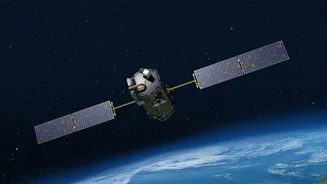
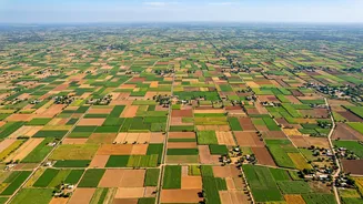
From hundreds of kilometres above Earth, satellites can see far more than the human eye. Equipped with advanced sensors, they capture information about the health and status of crops across vast areas. These sensors measure the light reflected from fields,
which can indicate factors like chlorophyll content, water stress, and overall plant vigour. By using different types of sensors, such as optical and radar, organisations like the Indian Space Research Organisation (ISRO) can monitor crops even on cloudy days, a crucial capability during the monsoon season. This stream of information, known as remote sensing data, provides a near-real-time snapshot of agricultural landscapes, transforming what was once a field-by-field task into a nationwide monitoring system.
From Pixels to Predictions
The true power of this data lies in its analysis. By processing these satellite images, researchers can create detailed maps showing which crops are being grown where and how healthy they are. This allows for remarkably accurate pre-harvest forecasts of crop yields. For instance, ISRO's FASAL (Forecasting Agricultural output using Space, Agro-meteorology and Land-based observations) programme provides early estimates for major crops like rice and wheat. This predictive capability is vital. Knowing months in advance that a region might have lower-than-average production allows governments and agencies to prepare, manage supply chains, and prevent market volatility, directly bolstering food security.
A National Shield Against Hunger
In India, satellite data is a cornerstone of agricultural governance. The Mahalanobis National Crop Forecast Centre (MNCFC), established in New Delhi, uses ISRO's satellite data to provide critical inputs for policy decisions. For example, the National Agricultural Drought Assessment and Monitoring System (NADAMS) uses satellite-derived information on rainfall and crop health to provide early warnings of drought conditions. This enables timely interventions to support affected farmers. Furthermore, this data supports the Pradhan Mantri Fasal Bima Yojana (PMFBY), India's crop insurance scheme, by helping to assess crop damage more accurately and settle claims more efficiently.
Empowering the Farmer
While the technology is powerful at a national scale, its benefits are increasingly trickling down to individual farmers. Initiatives like the Krishi-Decision Support System (Krishi-DSS) integrate satellite data with information on weather, soil, and water to provide farmers with actionable advice. This can include guidance on when to irrigate, how much fertiliser to apply, or early warnings about pest outbreaks. By enabling more precise resource management, satellite data helps farmers reduce costs, increase their yields, and practice more sustainable agriculture. This shift towards precision agriculture empowers farmers to make better-informed decisions, boosting their productivity and income.
Challenges and the Path Forward
Despite its immense potential, the use of satellite data is not without its challenges. Issues like the cost of high-resolution data, the need for ground-truthing to verify satellite findings, and ensuring the data reaches farmers in a usable format are ongoing hurdles. The complexity of analysing different crop types under varied conditions also requires continuous improvement in analytical models, often incorporating AI and machine learning. However, with advancements in satellite technology promising higher resolution imagery and more frequent monitoring, combined with better data integration platforms, the future is bright. These tools are becoming more accessible and essential for a climate-resilient agricultural sector.