




A Landmark Collaboration in the Sky
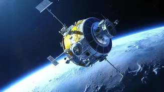
At the heart of this initiative is the NASA-ISRO Synthetic Aperture Radar (NISAR) mission, one of the most significant collaborations between the two space agencies. This sophisticated Earth-observation satellite is designed to monitor our planet's complex
processes with unprecedented detail. Launched from India, the mission represents a major milestone in the U.S.-India space partnership, combining American and Indian technology to tackle global challenges. NISAR’s primary goal is to provide a detailed, all-weather view of Earth's land and ice surfaces, making it a powerful tool for disaster management. By scanning nearly the entire planet every 12 days, it will create a reliable and consistent stream of data to help scientists and disaster response teams understand and react to environmental changes.
The Magic of 'Seeing' Through Clouds
The key to NISAR's power is Synthetic Aperture Radar, or SAR. Unlike optical satellites that are essentially cameras in space, SAR is an active sensor that sends out its own microwave signals and reads the echoes that bounce back. This has a crucial advantage: it can 'see' through clouds, smoke, and the darkness of night. This is a game-changer for a country like India, where monsoon floods are often obscured by thick cloud cover. While optical satellites are rendered blind, SAR can continuously monitor the situation on the ground, detecting the extent of floodwaters with remarkable accuracy. Smooth water surfaces reflect the radar signal away from the satellite, making them appear dark in the resulting images and easy to distinguish from land.
From Raw Data to Life-Saving Maps
NISAR is equipped with two different radar frequencies, L-band and S-band, which work in tandem. The L-band, provided by NASA, has a longer wavelength that can penetrate through vegetation canopies. This means it can detect floodwater hidden beneath forests and crops, a critical capability that has been a challenge for other satellites. The S-band, developed by ISRO, is excellent for monitoring agricultural areas and vegetation health. Data from the satellite can be turned into detailed flood extent maps within hours or a couple of days of an observation. This information allows disaster management agencies like the NDMA to understand exactly which areas are inundated, assess the damage, and direct rescue and relief efforts to where they are most needed.
A Virtual Stream Gauge for the Nation
Beyond just mapping where the water is, NISAR's technology can also measure changes in water levels with centimetre-level precision, even in areas with standing vegetation. By comparing images taken from the same orbit a few days apart, scientists can create maps showing how floodwaters are rising or receding. This technique effectively turns the satellite into a 'virtual stream gauge' for the entire country, providing crucial data for areas that lack physical ground sensors. This predictive capability helps inform downstream communities about the scale of an approaching flood, giving them valuable time to prepare and evacuate, potentially saving countless lives and properties.
More Than Just Floods
While smarter flood prediction is a headline application, NISAR’s potential extends far beyond that. The high-resolution data will be a boon for Indian agriculture, helping to monitor soil moisture and crop health across millions of farms. It will also be invaluable for monitoring landslides, tracking glacier melt in the Himalayas, studying coastal erosion, and even detecting ground subsidence in urban areas. By providing a comprehensive and regularly updated picture of our dynamic planet, the mission will support a wide range of scientific research and sustainable development goals for India, from managing water resources to tracking the impacts of climate change.