


The View from Orbit
Every year, monsoon rains bring life-giving water to India, but they can also unleash devastating floods that inundate vast swathes of land. During these chaotic events, getting a clear picture of the situation on the ground is a monumental challenge.
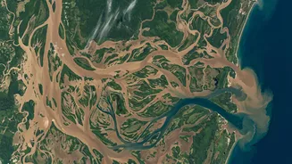
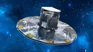
This is where space technology, spearheaded by the Indian Space Research Organisation (ISRO), plays a crucial, life-saving role. ISRO uses a constellation of Earth observation satellites to monitor the country's land and water bodies. These satellites act like cameras in the sky, providing a synoptic view that is impossible to achieve from the ground. They can survey hundreds of square kilometres at once, identifying which areas are submerged, tracking the progression of floodwaters, and assessing the extent of the damage. This information is vital for disaster management authorities to plan and execute effective rescue and relief operations.
The All-Weather, All-Night Advantage
One of the biggest hurdles in monitoring floods is the weather itself. The very clouds that bring the torrential rain also block the view of traditional optical satellites. This is where a game-changing technology called Synthetic Aperture Radar (SAR) comes in. Unlike optical cameras that need light, SAR is an active system that sends its own microwave pulses to the Earth's surface and measures the signals that bounce back. These microwaves can penetrate clouds, smoke, and darkness, allowing satellites like ISRO's RISAT (Radar Imaging Satellite) series to capture clear images of the ground, day or night, in any weather. Calm, standing floodwater acts like a mirror and reflects the radar signal away from the satellite, making it appear as a dark patch in the final image. This stark contrast with the brighter, rougher surrounding land makes it possible to map the precise extent of inundation with remarkable accuracy.
From Data to Action
Acquiring satellite data is just the first step. The real magic happens when this raw information is transformed into actionable intelligence. ISRO's National Remote Sensing Centre (NRSC) is the hub where data from various satellites is processed, analysed, and converted into detailed flood maps. These maps, often created by comparing pre-flood and post-flood imagery, highlight the affected villages, infrastructure, and agricultural lands. This crucial information is then disseminated in near-real-time to national and state disaster management authorities, including the National Disaster Management Authority (NDMA). This data is managed through a sophisticated geo-portal called the National Database for Emergency Management (NDEM), which provides a comprehensive repository of geospatial data to support decision-making during emergencies. Armed with these maps, response teams on the ground can identify the worst-hit areas, locate stranded populations, and plan the safest routes for rescue and delivery of essential supplies.
Global Cooperation for Local Impact
India's prowess in space-based disaster management is also part of a larger global effort. ISRO is a key member of the International Charter 'Space and Major Disasters', a worldwide collaboration of space agencies that voluntarily provide satellite data to help manage disasters anywhere in the world. This means that during a major flood event in India, ISRO can not only use its own satellites but also request data from international partners, ensuring a constant stream of information. This spirit of collaboration enhances the frequency and quality of satellite imagery available, giving disaster managers an even more complete picture. India's active role and leadership within this charter underscore its commitment to using space technology for humanitarian purposes, both at home and abroad.