


First, What Is GRITSS?
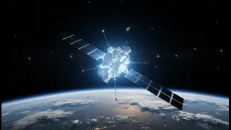
GRITSS stands for Geodetic Reference Instrument Transponder for Small Satellites. While the name is a mouthful, its purpose is profound: to perfect our planet's master measurement system. Think of the Earth as having a global, invisible grid that scientists
use to pinpoint every location. This is called the International Terrestrial Reference Frame (ITRF). It’s the foundation for everything from your phone’s GPS to tracking climate change. The problem is, this grid is created by combining data from three different ground-based tracking systems: GNSS (like GPS), Satellite Laser Ranging (SLR), and Very Long Baseline Interferometry (VLBI). Historically, linking these systems together introduced tiny but significant errors—on the scale of millimeters. GRITSS is a small satellite designed to act as a single, unified reference point in space. By being observable by all three systems at once, it aims to eliminate those errors and create a perfectly synchronized, ultra-precise global grid.
What's New: A Launch into Orbit
The reason GRITSS is making headlines now is because it just began its mission. On July 7, 2026, the technology demonstration spacecraft was successfully launched into low-Earth orbit. It hitched a ride on a SpaceX Falcon 9 rocket as part of a rideshare mission from California. This launch marks the culmination of a collaborative effort between NASA, the University of Massachusetts Lowell, and Dutch small-satellite manufacturer ISISPACE. After years of planning and development, the satellite is finally in space, ready to begin its work. The mission has now entered its initial phase, where ground teams will establish contact, check its systems, and prepare it for full scientific operations—a critical period known as the Launch and Early Orbit Phase (LEOP).
Why Millimeters Matter
You might wonder why achieving 1-millimeter accuracy for the entire planet is so important. The answer lies in the scale of the problems we face. When tracking sea-level rise, monitoring the melting of ice sheets, or observing the subtle movement of tectonic plates, millimeters are massive. A more accurate ITRF will directly enhance our ability to model climate change with greater confidence. It will improve predictions for global sea-level changes and help scientists better understand complex climate cycles like El Niño. Furthermore, this new level of precision provides a highly stable baseline for the next generation of topography missions, which can more accurately map everything from freshwater distribution in river basins to the shifting sands of deserts. For society, this translates into better resource management, more reliable navigation systems, and a clearer picture of how our planet is evolving.
The Indian Context
While GRITSS is a NASA mission, its impact is global, and it holds particular relevance for India's own scientific and strategic goals. India has a robust space program and is increasingly focused on leveraging geospatial technology for national development. The government's National Geospatial Policy 2022 aims to make India a global leader in this sector, promoting self-reliance, or 'Atmanirbhar Bharat'. A more accurate global reference frame like the one GRITSS will help build is a foundational asset that benefits all nations. Indian scientists and agencies working on critical issues like monsoon prediction, urban planning, disaster management, and infrastructure development under the PM Gati Shakti plan will be able to use the improved global data. Better data means better models and better decision-making, aligning perfectly with India’s ambition to use cutting-edge technology for sustainable growth.
What Remains Unclear
Despite the successful launch, the mission's ultimate success is still a work in progress. GRITSS is, at its heart, a 'technology demonstration'. Its primary goal is to prove that this novel method of unifying ground networks from space actually works as designed. The satellite must now undergo rigorous commissioning and calibration. Furthermore, the initial phase of the mission has some operational constraints. For example, it will only broadcast its specialised signals twice a day to a few specific NASA ground stations in the United States. Whether the mission can be expanded to include more international partners and provide continuous data is something that will be determined later. The road ahead involves carefully collecting data, validating the results, and proving that this small satellite can deliver on its very big promise of giving us the most accurate portrait of our home planet ever created.